Scheibenberg, Summit and geological formation in Ore Mountains, Germany
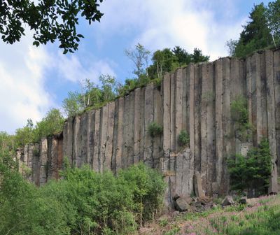
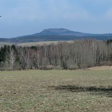
Scheibenberg is a mountain summit in the Ore Mountains of Germany, characterized by tall vertical basalt columns that line its slopes like organ pipes. The summit is also officially recognized as a geotope, a site of outstanding geological value.
The mountain was shaped by volcanic forces millions of years ago, producing the basalt columns that remain visible today. In the 18th and 19th centuries, geologists traveled here to argue over competing theories about how rocks are formed.
The mountain draws walkers from nearby towns who come to see the basalt columns rising along the slopes. The sight of those stacked rock formations is something people often stop to photograph or simply stand before in silence.
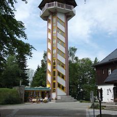
Marked hiking trails lead to the basalt columns and up to the summit, where a lookout tower offers open views over the Ore Mountains. There is also a restaurant at the top, which makes it easy to take a break after the walk up.
Although the site received National Geotope status in 2006, fewer than 80 locations across Germany hold this designation, making it quite rare. What makes this one stand out is that the columns here were once studied by scientists who did not yet agree on whether basalt was formed by volcanoes or by water.
The community of curious travelers
AroundUs brings together thousands of curated places, local tips, and hidden gems, enriched daily by 60,000 contributors worldwide.