Enable Location

We need your location to show you interesting places around you

Discover nearby places

Find interesting locations and hidden gems around you

Precise directions

Get accurate directions and distances to places

Your location is never shared with other users. It's only used when you tap the location button.

Rangsdorf

Log in to your account

Start exploring — it's free

Trusted by 63,174 travelers worldwide

Continue with Google
Continue with Apple
or

We will send you a code to connect

By continuing, you accept our Terms and Conditions and our Privacy Policy

Check your inbox

We've sent a pincode in your inbox. Please enter the code below.

Discussion Reviews 1 Photos
21.1k Popularity

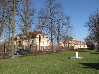
Rangsdorf, municipality in Brandenburg, Germany

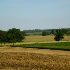
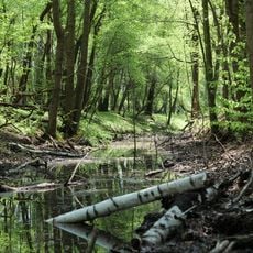
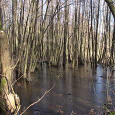
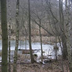
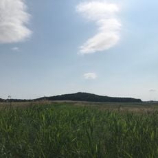
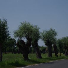
Rangsdorf is a small municipality in the Teltow-Fläming district of Brandenburg, situated at about 118 feet (36 meters) elevation across just over 33 square kilometers (13 square miles). Open fields surround the town, and it includes the Rheinagsdorf Lake, a popular swimming spot with a beach area.

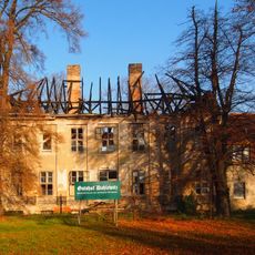
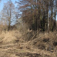
Rangsdorf was founded roughly 650 years ago with about 1,079 residents recorded in 1875. The town had an airfield that operated as a regular airport until around 1940, later becoming a site connected to significant wartime events.

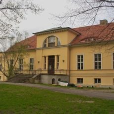
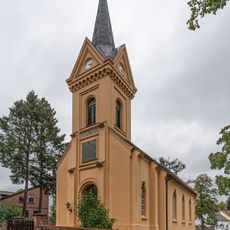
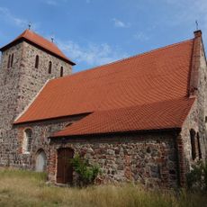
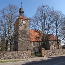
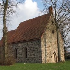
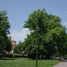
Rangsdorf's name reflects its roots in local history. The church at the center hosts gatherings where residents meet for services and community events throughout the year.

Rangsdorf is easily reached from Berlin and works best for visits during summer months when the lake is ideal for swimming. The beach area at Rheinagsdorf Lake has picnic spots and refreshment options, with the town regularly adding visitor amenities.

Rangsdorf's old airfield played a role in an attempt on Adolf Hitler's life. In 1944, Claus Schenk Graf von Stauffenberg took off from this site on a mission that became significant in German history.

The community of curious travelers

AroundUs brings together thousands of curated places, local tips, and hidden gems, enriched daily by 60,000 contributors worldwide.

Start exploring
Elevation above the sea
41 m
Shares border with
Blankenfelde-Mahlow, Mittenwalde, Zossen
Address
Seebadallee 30
GPS coordinates
52.28306,13.43306
Latest update
February 3, 2026 19:30
Around this place
Gutsanlage Dahlewitz
Germany

Gutsanlage Dahlewitz

4.3 km
Rangsdorfer See
Germany

Rangsdorfer See

2.6 km
Groß-Machnower Weinberg
Germany

Groß-Machnower Weinberg

5.1 km
Zülowgrabenniederung
Germany

Zülowgrabenniederung

3.4 km
Gutshaus Groß Machnow
Germany

Gutshaus Groß Machnow

2.3 km
Village church Rangsdorf
Germany

Village church Rangsdorf

1.3 km
Ehemaliger Blankenfelder See
Germany

Ehemaliger Blankenfelder See

4.1 km
Village church Dahlewitz
Germany

Village church Dahlewitz

4.3 km
Machnower See
Germany

Machnower See

1.2 km
Village church Groß Machnow
Germany

Village church Groß Machnow

2.4 km
Dorfkirche Brusendorf
Germany

Dorfkirche Brusendorf

6 km
Germany

Village church Klein Kienitz

4.3 km
Glasowbachniederung
Germany

Glasowbachniederung

2.6 km
Germany

Naturdenkmal Stieleichen (Baumgruppe) 0,5 km S Kirche, Straßenbäume der B 96, südlicher Ortsausgang; Flur 4, Flurstück 326, 194 in Groß Machnow

2.3 km
Wein-Berg
Germany

Wein-Berg

5.1 km
Germany

Naturdenkmal Stieleiche (Quercus robur) (Baum) wenig O Römerschanze; Flur 7, Flurstück 177 in Rangsdorf

2.1 km
Germany

Wein-Berg

2.9 km
Germany

Naturdenkmal Vier Stieleichen (Quercus robur) (Baumgruppe) 1,1 km NW Kirche, Ostufer Rangsdorfer See/Krumme Lanke; Flur 1, Flurstück 19, 20, 22, 23 in Rangsdorf

2.4 km
Großmachnower Weinberg
Germany

Großmachnower Weinberg

5.1 km
Germany

Heide-Berg

3.7 km
Naturdenkmal Weiße Maulbeere (Morus alba) (Baum) im Gutshof, SW Kirche; Flur 4, Flurstück 948  in Groß Machnow
Germany

Naturdenkmal Weiße Maulbeere (Morus alba) (Baum) im Gutshof, SW Kirche; Flur 4, Flurstück 948 in Groß Machnow

2.3 km
Zülow-Niederung
Germany

Zülow-Niederung

858 m
Kopfweidenallee Groß Machnow
Germany

Kopfweidenallee Groß Machnow

1.9 km
Naturdenkmal Baumgruppe Eichen und Linden am Kriegsdenkmal Groß Machnow
Germany

Naturdenkmal Baumgruppe Eichen und Linden am Kriegsdenkmal Groß Machnow

2.4 km
Germany

Naturdenkmal Lindenreihe (Tilia spec.) (Baumreihe) Weg zwischen Friedensallee (in Höhe Frühlingsstraße) und Römerschanze; Flur 7, Flurstück 140, 142/2 in Rangsdorf

2.1 km
Germany

Naturdenkmal Stieleiche (Quercus robur) (Baum) Alemannenallee, am nördlichen Grundstücksrand; Flur 12 und 5, Flurstück 3, 245 in Rangsdorf

2.2 km
Germany

Bücker-Luftfahrt- und Europäisches Eissegel-Museum

1.6 km
Wasserturm Dahlewitz
Germany

Wasserturm Dahlewitz

4.4 km
Show the full map
Reviews
Share your experience

No review yet

Discussions
Start a discussion...

No discussion yet

« Rangsdorf - municipality in Brandenburg, Germany » is provided by Around Us (aroundus.com). Images and texts are derived from Wikimedia project under a Creative Commons license. You are allowed to copy, distribute, and modify copies of this page, under the conditions set by the license, as long as this note is clearly visible.

Discover hidden gems everywhere you go!

From secret cafés to breathtaking viewpoints, skip the crowded tourist spots and find places that match your style. Our app makes it easy with voice search, smart filtering, route optimization, and insider tips from travelers worldwide. Download now for the complete mobile experience.

Around Us App Screenshot

A unique approach to discovering new places

Le Figaro

All the places worth exploring

France Info

A tailor-made excursion in just a few clicks

20 Minutes

Around Us
Travel Guide & Maps
Download

Send to your phone

QR Code
1

Open the camera app on your mobile.

2

Point at the QR code with your camera. A notification will appear.

3

Tap the notification to open the link.