Enable Location

We need your location to show you interesting places around you

Discover nearby places

Find interesting locations and hidden gems around you

Precise directions

Get accurate directions and distances to places

Your location is never shared with other users. It's only used when you tap the location button.

Bendorf

Log in to your account

Start exploring — it's free

Trusted by 62,855 travelers worldwide

Continue with Google
Continue with Apple
or

We will send you a code to connect

By continuing, you accept our Terms and Conditions and our Privacy Policy

Check your inbox

We've sent a pincode in your inbox. Please enter the code below.

Bendorf, Administrative municipality in Mayen-Koblenz district, Germany.

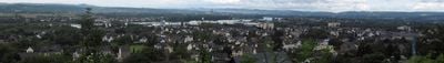
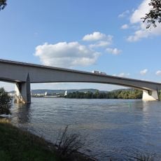
Bendorf sits on the right bank of the Rhine River, about 7 kilometers north of Koblenz, and covers roughly 24 square kilometers. The town consists of four main districts: Bendorf proper, Sayn, Mülhofen, and Stromberg, which together form a single administrative unit.

The opening of a Rhine port in 1900 brought industrial development to the area, supported by iron ore mining at Trierischer Loh. These mining and metalworking activities shaped the economic life of the town for many decades.

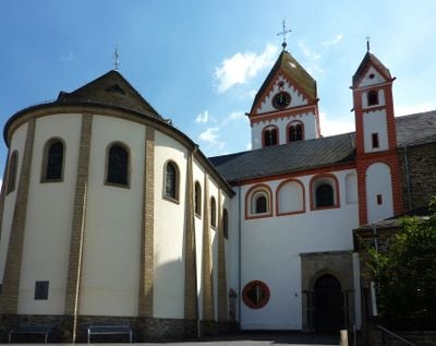
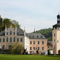
The separate districts have different characters: Bendorf proper feels more modern and ordinary, while Sayn attracts visitors with its old stone buildings and narrow streets. Each part has its own shops and gathering places where locals spend their daily time.

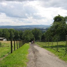
Visitors can find the administrative center in the town park, where information about the different districts is available. The town is best explored by walking north to south, passing through the outer districts before reaching the center.

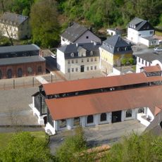
The Sayner Hütte is one of the few surviving examples of a fully equipped metalworking foundry from the 1800s. Today it operates as a museum and shows how workers once carried out their craft.

The community of curious travelers

AroundUs brings together thousands of curated places, local tips, and hidden gems, enriched daily by 60,000 contributors worldwide.

Start exploring
Location
Elevation above the sea
115 m
GPS coordinates
50.42972,7.57028
Latest update
December 20, 2025 13:07
« Bendorf - Administrative municipality in Mayen-Koblenz district, Germany » is provided by Around Us (aroundus.com). Images and texts are derived from Wikimedia project under a Creative Commons license. You are allowed to copy, distribute, and modify copies of this page, under the conditions set by the license, as long as this note is clearly visible.

Discover hidden gems everywhere you go!

From secret cafés to breathtaking viewpoints, skip the crowded tourist spots and find places that match your style. Our app makes it easy with voice search, smart filtering, route optimization, and insider tips from travelers worldwide. Download now for the complete mobile experience.

Around Us App Screenshot

A unique approach to discovering new places

Le Figaro

All the places worth exploring

France Info

A tailor-made excursion in just a few clicks

20 Minutes

Around Us
Travel Guide & Maps
Download

Send to your phone

QR Code
1

Open the camera app on your mobile.

2

Point at the QR code with your camera. A notification will appear.

3

Tap the notification to open the link.