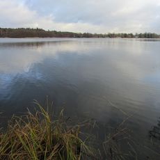
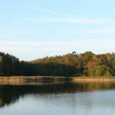
Schaalsee, Glacial lake in Herzogtum Lauenburg, Germany.
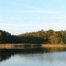
Schaalsee is a glacial lake located between Herzogtum Lauenburg and adjacent regions, featuring numerous islands and peninsulas. Its waters reach depths of up to 72 meters and span across two federal states.
The lake formed from glacial activity during the last ice age and later became a border water between East and West Germany. This division protected the area from human interference and allowed nature to develop with minimal disturbance.
The Schaale river drains the lake at Zarrentin, the largest settlement on its shore, and flows south to the Sude and then the Elbe. The lake's name is recalled in the village of Schaal, and the water is fished for pike and perch; angling permits and boats are issued in Zarrentin and Groß Zecher.
The lake offers water sports, walking paths along the shoreline, and bird watching, especially in the surrounding nature reserves. Nearby towns provide accommodations, dining options, and access points for various water activities.
The Schaalseekanal, built between 1923 and 1925, links the Schaalsee through the Phulsee, Pipersee and Salemer See with the Großer Küchensee, part of the Ratzeburger See. At its end the Farchau hydroelectric plant uses the drop to the lower water level of the Ratzeburger See. The canal lies on the surface, not underground or elevated.
The community of curious travelers
AroundUs brings together thousands of curated places, local tips, and hidden gems, enriched daily by 94,637 contributors worldwide.