Schneehübel, Mountain peak in Eibenstock, Germany
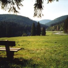
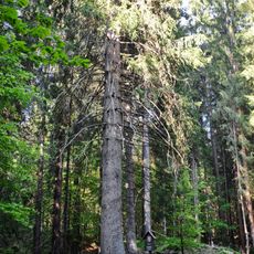
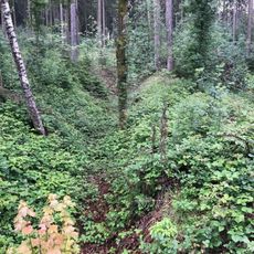
Schneehübel is a mountain peak in the western Ore Mountains of Saxony that rises to 974 meters with steep slopes and thick forest coverage. A monumental cross stands at its summit and can be seen from many points across the surrounding valleys.
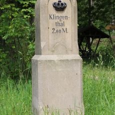
This peak served as a natural boundary marker in the Vogtland region since medieval times, separating different territorial divisions. Its prominent position made it an established reference point between various administrative areas.
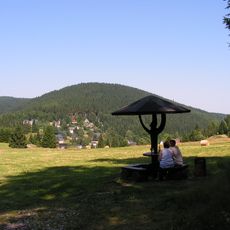
The cross at the summit shapes how locals and visitors experience the landscape as a shared landmark. It has become a focal point that connects people from surrounding communities.
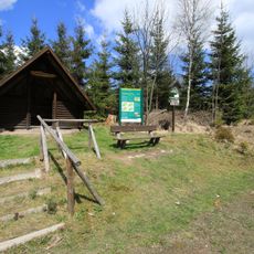
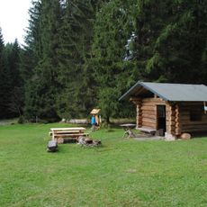
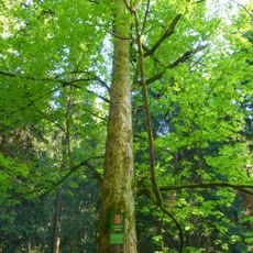
Hikers can reach the summit via marked trails from Eibenstock, with the main route starting near the Wurzelrudis recreational area. The paths are well-marked and accessible year-round, though winter conditions may require extra caution depending on snow levels.
The cross at the summit is visible from many locations across the surrounding valleys and serves as a practical navigation aid for hikers and residents. Many people use this mountain as a convenient day-trip destination rather than as a serious climbing challenge.
Location: Eibenstock
Elevation above the sea: 974 m
GPS coordinates: 50.42688,12.57625
Latest update: December 14, 2025 09:41
Wilkau-Haßlau–Carlsfeld narrow gauge railway
1.1 km
Talsperre Carlsfeld
1.7 km
Großer Kranichsee
2.1 km
Holy Trinity Church
1.2 km
Brückenberg
3.7 km
Přebuzské vřesoviště
5.7 km
Am Riedert
4.7 km
Dreibächel
1.4 km
Rehhübel
5.6 km
Jedle pod skálou v Nancy
5.9 km
Vysoký smrk v Nancy
5.5 km
Nový Nancin smrk
5.5 km
Klen Na konci světa
5.7 km
Nebenzollamt Oberwildenthal
5 km
Auersbergturm
6 km
Památník obětem zajateckého tábora Sauersack
4.8 km
Frühbußer Straße
2.9 km
Royal Saxon milestone in Blechhammer
2.6 km
Buttergasse 4
1.1 km
Königlich-Sächsischer Meilenstein Alte Poststraße Wildenthal
4.9 km
Gasthaus Talsperre Carlsfeld
1.4 km
Bahnhof Carlsfeld
1.1 km
Former forester’s house Wilzschmühle
4.1 km
Station 135 Auersberg
6 km
Kgl.-sächs. Postmeilenstein Carlsfelder Straße Wildenthal
4.2 km
Bridge of road III/21012 over the Rolava
5.5 km
Schleifstein einer ehemaligen Papiermühle Blechhammer (Eibenstock), am Waldrand, Abzweig Kleiner Wilzschweg von Carlsfelder Hauptstraße
2.6 km
Most silnice III/21012 přes Rolavu
4.8 kmVisited this place? Tap the stars to rate it and share your experience / photos with the community! Try now! You can cancel it anytime.
Discover hidden gems everywhere you go!
From secret cafés to breathtaking viewpoints, skip the crowded tourist spots and find places that match your style. Our app makes it easy with voice search, smart filtering, route optimization, and insider tips from travelers worldwide. Download now for the complete mobile experience.
A unique approach to discovering new places❞
— Le Figaro
All the places worth exploring❞
— France Info
A tailor-made excursion in just a few clicks❞
— 20 Minutes