Billetal, Nature reserve near Wentorf bei Hamburg, Germany
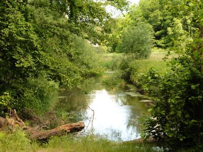
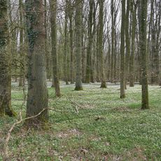
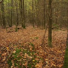
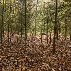
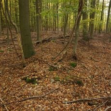
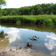
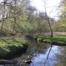
Billetal is a nature reserve following the Bille River through areas shaped by ancient glaciers, with wet meadows, spring-fed slopes, and established woodlands. The protected land spans across eight municipalities and displays the natural results of Ice Age meltwater activity.
The valley formed during the last Ice Age from melting glacial water, shaping the terrain that exists today. Official protection came in 1987 to preserve this glacially-formed landscape for the future.
The protected area maintains traditional agricultural practices while implementing conservation measures to preserve the natural heritage of northern German landscapes.
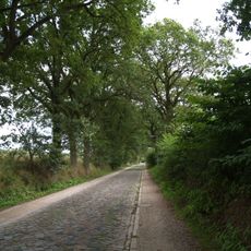
A hiking route of roughly 17 kilometers connects different access points with varying walk lengths depending on where you start. Spring through autumn offers the best conditions, when paths are dry and the area is most accessible.
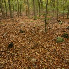
Floodplain forests display exposed root systems from fallen trees that have been uncovered over time. Himalayan balsam plants growing here eject seeds suddenly when touched or brushed against.
Location: Wentorf bei Hamburg
Location: Wohltorf
Location: Aumühle
Location: Sachsenwald
Location: Kuddewörde
Location: Grande
Location: Witzhave
Location: Reinbek
Inception: 1987
GPS coordinates: 53.55640,10.32390
Latest update: December 14, 2025 17:40
Bismarck Mausoleum
3.3 km
Bismarck-Museum Friedrichsruh
3.2 km
Friedrichsruh railway station
3.4 km
Grander Mühle
5 km
Großsteingrab Sachsenwald Alter Hau 1
1.3 km
Bismarcksäule
3.6 km
Heilig-Geist-Kirche
4.6 km
Bismarck-Gedächtnis-Kirche
4 km
Stolperstein dedicated to Johannes Kröger
5.1 km
Stolperstein dedicated to Arthur Felix Goldschmidt
6 km
Talwald Hahnenkoppel
2.1 km
Großsteingrab Sachsenwald Alter Hau 3
1.2 km
Forsthaus
3.1 km
Großsteingrab Sachsenwald Fahrenhorst 1
1.7 km
Am Museum 5
3.2 km
Hannemanns Mühle
5.4 km
Großsteingrab Sachsenwald Fahrenhorst 2
2.4 km
Stolperstein dedicated to Katharina Goldschmidt née Horschitz
6 km
Königstraße 3
5.6 km
Bille
4.6 km
Wälder im Sachsenwald und Schwarze Au
5.1 km
Großsteingrab Sachsenwald Fahrenhorst 3
2.1 km
Ehem. Clemens-Schulz-Heim
6.2 km
Ehem. Victor-Gollancz-Haus, ehem. Villa Dobbertin
5.9 km
Straße zwischen Ohe und Sachsenwaldau
2.6 km
Turnhalle von 1958
3.9 km
Neue Oberförsterei
2.9 km
Alte Hege 4 - 6
3 kmVisited this place? Tap the stars to rate it and share your experience / photos with the community! Try now! You can cancel it anytime.
Discover hidden gems everywhere you go!
From secret cafés to breathtaking viewpoints, skip the crowded tourist spots and find places that match your style. Our app makes it easy with voice search, smart filtering, route optimization, and insider tips from travelers worldwide. Download now for the complete mobile experience.
A unique approach to discovering new places❞
— Le Figaro
All the places worth exploring❞
— France Info
A tailor-made excursion in just a few clicks❞
— 20 Minutes