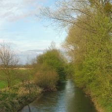
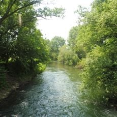
Boker Kanal, Historic irrigation canal in Paderborn, Germany
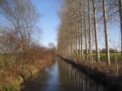
The Boker Canal is an irrigation canal in North Rhine-Westphalia, Germany, running from Paderborn through Delbrück to Lippstadt. It was built to make the dry, nutrient-poor soils of the Boker Heide usable for farming and today also helps regulate groundwater levels in the area.
The canal was built in 1853 under engineer Hermann Wurffbain to turn the largely barren Boker Heide into farmland. This was part of a broader effort in the 19th century to open up the region's difficult soils through targeted irrigation.
The Boker Canal is a popular route for cyclists and walkers exploring the flat countryside of the Paderborn plateau. The long rows of poplars along the water are a recognizable feature of this area and follow visitors along the entire path.
A developed cycling path follows the canal from Paderborn to Lippstadt and is well suited for day trips by bike. The route is flat and largely open to the sun, so bringing enough water is a good idea on warm days.
The original system included 16 main locks that allowed water to reach farmland up to about 2 miles (3 kilometers) from the canal. Several of these old structures are still visible along the waterway today.
The community of curious travelers
AroundUs brings together thousands of curated places, local tips, and hidden gems, enriched daily by 60,000 contributors worldwide.