Bosenberg, Mountain summit in Sankt Wendel, Germany
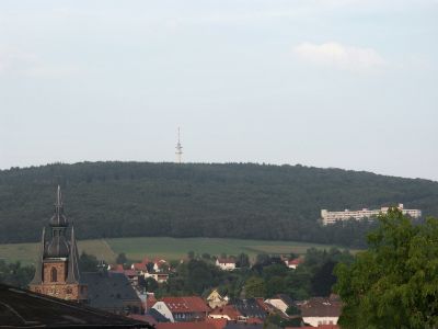
The Bosenberg is a mountain summit in Sankt Wendel that reaches 485 meters and marks the highest point within the town's boundaries. A Deutsche Telekom telecommunications tower stands at the peak and broadcasts radio signals to the surrounding area.
A wooden observation tower once stood on the mountain and operated for many years before structural damage led to its removal in 2003. This tower had been a landmark for visitors seeking elevated views.
The mountain hosts sporting events throughout the year that draw athletes and spectators from the surrounding region. These competitions have become a regular part of local life and community identity.
The summit is accessible by car with parking available near the telecommunications tower, making it convenient for visitors of all abilities. Hiking and biking trails also lead to the top for those preferring to approach on foot.
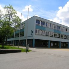
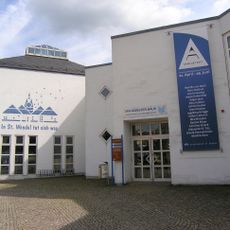
At the base of the mountain stands a specialized medical clinic established in 1975 that focuses on treating tinnitus. This facility has gained national recognition and draws patients from across the country seeking treatment.
Location: Sankt Wendel
Elevation above the sea: 485 m
GPS coordinates: 49.47522,7.19950
Latest update: December 14, 2025 20:04
Wendalinus basilica
2.2 km
Gymnasium Wendalinum
2.2 km
Cusanus Gymnasium St.Wendel
1.9 km
Paqué brewery, St. Wendel
2.2 km
Missionshauskirche
1.3 km
Mary Magdalene Chapel
2.2 km
Margarethenkirche
3.8 km
Stadtkirche (Sankt Wendel)
2.3 km
St. Anna
2.8 km
Heilig Geist
3.1 km
St. Willibrord
3.8 km
Evangelical Church
5.3 km
Christkönig-Kirche
3.2 km
Synagoge (St. Wendel)
2.3 km
St. Anna
4.8 km
Evangelische Kirche (Werschweiler)
3.6 km
Saint Anne Chapel (Wallesweilerhof)
5.2 km
Evangelische Kirche (Hoof)
3.5 km
Omnibuswartehalle St. Wendel
2.6 km
Reitscheider Kreuz
4.9 km
Altes Rathaus
2.3 km
St. Marien
4.4 km
Stadt- und Kreisbibliothek St. Wendel
2.4 km
Wendelinus-Golfpark
5.1 km
Wendalinusbrunnen
2.1 km
Bahnhofstraße 21-23
2.5 km
Eisenbahnbrücke
3.1 km
Naturschutzgebiet Ostertal zwischen Herchweiler und Marth
4.6 kmVisited this place? Tap the stars to rate it and share your experience / photos with the community! Try now! You can cancel it anytime.
Discover hidden gems everywhere you go!
From secret cafés to breathtaking viewpoints, skip the crowded tourist spots and find places that match your style. Our app makes it easy with voice search, smart filtering, route optimization, and insider tips from travelers worldwide. Download now for the complete mobile experience.
A unique approach to discovering new places❞
— Le Figaro
All the places worth exploring❞
— France Info
A tailor-made excursion in just a few clicks❞
— 20 Minutes