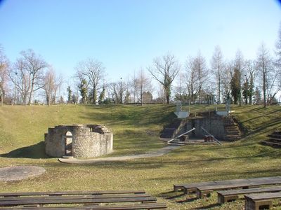
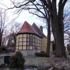
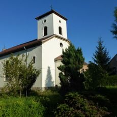
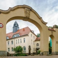
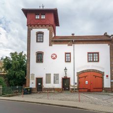
Burg Groitzsch, Medieval castle ruins in Groitzsch, Germany.
Burg Groitzsch is a castle situated on a strategic hill overlooking the White Elster River valley in Saxony. The preserved remains include a partially reconstructed circular chapel and a round tower dating from 1080.
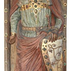
The castle came under the control of Count Wiprecht von Groitzsch through a land exchange in 1073, marking its first documented record. The fortification underwent several reconstructions and expansions across the centuries.
The castle demonstrates a shift from wooden structures to stone construction, reflecting how building methods changed across the region during the 11th century. Visitors can still see this early form of stone architecture in the preserved foundations and walls today.
The castle grounds are free to visit and require no admission fee. The hilltop location offers good views of the surrounding landscape and is easily reached on foot.
Archaeological excavations have uncovered layers reaching six meters deep, documenting five distinct building phases at the site. Pottery and metal artifacts found there help visitors understand the long history of occupation.
Location: Groitzsch
GPS coordinates: 51.15957,12.27513
Latest update: December 8, 2025 21:00
Pegau Abbey
1.7 km
Stadtkirche St. Laurentius
1.7 km
Erbs Brickworks
1.1 km
Rathaus Pegau
1.6 km
Pfarrholz Groitzsch
910 m
Kgl.-sächs. Postmeilenstein Groitzsch Gedenkstein
42 m
Gottesackerkirche St. Johannis
2 km
Marienbrücke
136 m
Polish-Saxon Post Milestone in Pegau
1.2 km
Albert-Hain-Brücke
1.1 km
Sebastiansgarten und Träubelwiese
1.4 km
Kirche mit Ausstattung A -
2.4 km
Wasserturm Groitzsch
828 m
Elsteraue südlich Zwenkau
1.2 km
Audigast Manor
1.7 km
Pfarrhaus (zwei Hausnummern) in geschlossener Bebauung Kirchplatz 6; 7
1.7 km
Ziegelei Erbs
1.1 km
Wohnhaus in geschlossener Bebauung, ehemaliges Postgebäude Kirchplatz 11
1.8 km
Wohnhaus in offener Bebauung und Wappenstein am Haus Leipziger Straße 24
1.3 km
Ehemaliges Gerichtsgebäude und angebautes Wohnhaus, sowie Stadtmauerturm auf dem Grundstück, Einfriedung des Geländes und Torbogen Schloßplatz 12
2 km
Feuerwache (mit Schlauchturm), Inschrifttafel Ernst-Reinsdorf-Straße 1
1.6 km
Wohnhaus (mit Apotheke) in halboffener Bebauung (zwei Hausteile), in Ecklage Martin-Luther-Platz Helbigstraße 22
1.5 km
Sender Wiederau (Sachgesamtheit)
2.9 km
Wohnhaus (mit Inschrifttafel) in geschlossener Bebauung, in Ecklage Schloßstraße Kirchplatz 9
1.8 km
Einzeldenkmale der Sachgesamtheit Sender Wiederau: Senderhaus (mit zwei Sendern und Kühlanlage), daran angebaut ehemaliges Verwaltungsgebäude, Maschinenhaus (mit zwei Schiffsdiesel), daran angebautes Umspannhaus, Kulturhaus mit Werkstattgebäude, A
2.9 km
Ehemaliges Gasthaus, in Ecklage Schlossergasse, zum Grundstück gehört auch benachbartes Wohnhaus in geschlossener Bebauung Markt 3
1.6 km
Wasserturm Pegau
2.2 km
Postgebäude in offener Bebauung, mit Anbau, Garagen und Einfriedung Bahnhofstraße 24
2.3 kmVisited this place? Tap the stars to rate it and share your experience / photos with the community! Try now! You can cancel it anytime.
Discover hidden gems everywhere you go!
From secret cafés to breathtaking viewpoints, skip the crowded tourist spots and find places that match your style. Our app makes it easy with voice search, smart filtering, route optimization, and insider tips from travelers worldwide. Download now for the complete mobile experience.
A unique approach to discovering new places❞
— Le Figaro
All the places worth exploring❞
— France Info
A tailor-made excursion in just a few clicks❞
— 20 Minutes