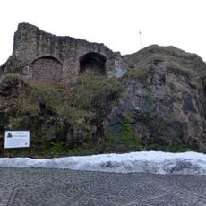
Burgruine Rechenberg, Medieval castle ruin in Rechenberg-Bienenmühle, Germany.
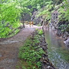
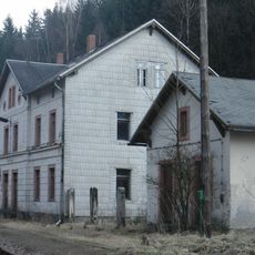
Burgruine Rechenberg is a castle ruin positioned on a hilltop above the Freiberger Mulde river with remains from multiple building periods. The site displays the structural foundations of defensive towers and buildings scattered across the terrain, revealing how the fortress was organized over time.
The fortress was first mentioned in 1270 as a wooden fortification before being rebuilt in stone. A fire in 1586 destroyed significant sections of the structure and led to its gradual abandonment as a military site.
The ruins reveal how people defended themselves during the medieval period through military architecture and fortification design. You can trace different building phases in the walls, each reflecting distinct periods of construction and modification.
You can visit the ruins any time of year without paying an entrance fee and explore at your own pace. Parking is located near the site entrance, making it easy to access the grounds.
This fortress ranks among the largest medieval military structures in the Erzgebirge region and displays three separate structural cores from different construction eras. This layering of construction allows visitors to trace how defensive design evolved over centuries.
Location: Rechenberg-Bienenmühle
GPS coordinates: 50.73610,13.55620
Latest update: December 9, 2025 20:22
Neugrabenflöße
4.3 km
Kirche Nassau
2.9 km
Church of Saint John the Baptist
3.4 km
Kirche Rechenberg-Bienenmühle
144 m
Steinkuppe
3.5 km
Gimmlitzwiesen
4.6 km
Dům če. 124
3.2 km
Sächsisches Brauereimuseum Rechenberg
62 m
Rectory (Český Jiřetín)
3.2 km
Kříž u kostela v Českém Jiřetíně
3.4 km
Monument to the fallen in Český Jiřetín
3.2 km
Podstavec kříže v Českém Jiřetíně u cesty k Horní Vsi
3.2 km
Bahnhof Holzhau
2.5 km
Wohnhaus mit Sonnenuhr und späterem Anbau mit Laden Markt 1
71 m
Illingmühle
4.4 km
Brauerei Rechenberg Rechenberg-Bienenmühle
67 m
Müllermühle
4.7 km
Herrenhaus Rechenberg
53 m
Kgl.-sächs. Postmeilenstein Bienenmühle
1.9 km
Schule (heute Wohnhaus) Muldentalstraße 25
87 m
Kgl.-sächs. Postmeilenstein Holzhau
1.8 km
Kgl.-sächs. Postmeilenstein Töpferwald
3.1 km
Station 80 Drachenkopf
3.3 km
Wegestein Nassau (Frauenstein)
1.3 km
Kříž na rozcestí pod kostelem v Českém Jiřetíně
3.4 km
Burgruine An der Schanze -
5 m
Wohnstallhaus Alte Straße 77
125 m
St.-Michaelis-Stolln Clausnitz
4.7 kmVisited this place? Tap the stars to rate it and share your experience / photos with the community! Try now! You can cancel it anytime.
Discover hidden gems everywhere you go!
From secret cafés to breathtaking viewpoints, skip the crowded tourist spots and find places that match your style. Our app makes it easy with voice search, smart filtering, route optimization, and insider tips from travelers worldwide. Download now for the complete mobile experience.
A unique approach to discovering new places❞
— Le Figaro
All the places worth exploring❞
— France Info
A tailor-made excursion in just a few clicks❞
— 20 Minutes