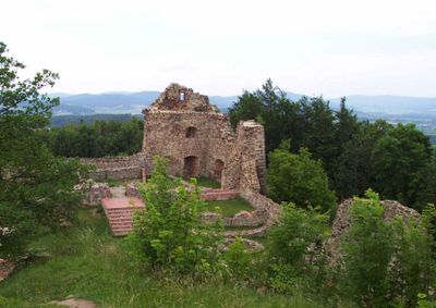
Burg Runding, Medieval castle ruin in Runding, Germany
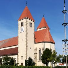
Burg Runding is a castle ruin perched on elevated terrain in a Bavarian village and features stone walls that remain largely intact. The site displays characteristics typical of medieval fortifications, including narrow defensive openings and remnants of multiple structures.
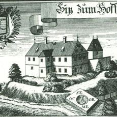
The fortress was founded in 1118 and served as a strategic outpost during territorial disputes between noble families in medieval Bavaria. It lost importance over time as power structures in the region shifted.
The remaining walls show the craftsmanship of medieval builders through narrow openings and defensive passages typical of fortified sites from that era. These architectural traces help visitors understand how defenders once monitored the surrounding land.
The ruins are accessible via marked paths from the village of Runding, with parking available at the base of the hill. The climb requires some effort, and sturdy footwear is advisable, especially when the paths are damp.
From the ruins, views open across multiple valleys, offering insight into the strategic importance of the location. Underground passages beneath the site connect different areas and reveal details about daily life within the fortification.
Location: Runding
Inception: 1118
Address: Zur Burgruine 12
GPS coordinates: 49.21786,12.76234
Latest update: December 8, 2025 21:07
Wolframslinde
4.8 km
Pfarrkirche Mariä Himmelfahrt
5 km
Burg Chameregg
4.2 km
Chammünster Abbey
5 km
Schloss Hof
5.2 km
Schloss Chameregg
3.8 km
Wallfahrtskirche Sankt Ulrich
3.2 km
Mariahilfkapelle
6.6 km
Wallfahrtskirche St. Walburga
3.8 km
St. Peter und Paul
2.4 km
Sankt Elisabeth (Blaibach)
6.6 km
Katholische Expositurkirche St. Ägidius
5.3 km
St. Andreas
385 m
Kalvarienbergkapelle Christus an der Geißelsäule
2.6 km
Waldlerhaus
3.5 km
Beinhaus Chammünster 45 a in Cham (Oberpfalz)
5 km
Grenzstein
4.9 km
Pfarrer-Biendl-Straße 1
5.1 km
Jüdischer Friedhof
5.5 km
Grenzstein Piedendorfer Straße 2 in Cham (Oberpfalz)
4.9 km
Regentalaue und Chambtal mit Rötelseeweihergebiet
4.6 km
Totenbretter
3.5 km
Pfarrhof
2.4 km
Grabkapelle Chammünster 45 a in Cham (Oberpfalz)
5 km
Backhaus Pfarrer-Biendl-Straße 1 in Cham (Oberpfalz)
5.1 km
Grabkreuz Chammünster 45 a in Cham (Oberpfalz)
5 km
Friedhofsmauer Pfarrer-Biendl-Straße 4 in Cham (Oberpfalz)
5 km
Nepomuk Windischbergerdorf
4.6 kmVisited this place? Tap the stars to rate it and share your experience / photos with the community! Try now! You can cancel it anytime.
Discover hidden gems everywhere you go!
From secret cafés to breathtaking viewpoints, skip the crowded tourist spots and find places that match your style. Our app makes it easy with voice search, smart filtering, route optimization, and insider tips from travelers worldwide. Download now for the complete mobile experience.
A unique approach to discovering new places❞
— Le Figaro
All the places worth exploring❞
— France Info
A tailor-made excursion in just a few clicks❞
— 20 Minutes