Enable Location

We need your location to show you interesting places around you

Discover nearby places

Find interesting locations and hidden gems around you

Precise directions

Get accurate directions and distances to places

Your location is never shared with other users. It's only used when you tap the location button.

Burg Grimnitz

Log in to your account

Start exploring — it's free

Trusted by 61,457 travelers worldwide

Continue with Google
Continue with Apple
or

We will send you a code to connect

By continuing, you accept our Terms and Conditions and our Privacy Policy

Check your inbox

We've sent a pincode in your inbox. Please enter the code below.

Burg Grimnitz

Burg Grimnitz, Medieval castle ruin in Joachimsthal, Germany

Description

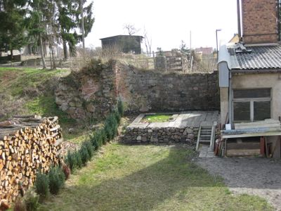
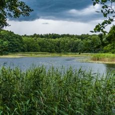
Burg Grimnitz is a castle ruin situated on a sandy elevation between Werbellinsee and Grimnitzsee lakes in the Brandenburg region. The surviving vaulted cellars and foundation walls reveal the original structure and construction methods of the fortress.

History

The fortress was founded in 1247 as a Romanesque border stronghold serving the Ascanian rulers as a hunting lodge for generations. Its decline began around 1340 as its strategic importance diminished over time.

Culture

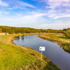
The name derives from the nearby Grimnitzsee lake, reflecting how water bodies shaped medieval settlement choices. Visitors can observe how the location between two lakes influenced the selection of this spot for a fortress.

Practical

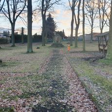
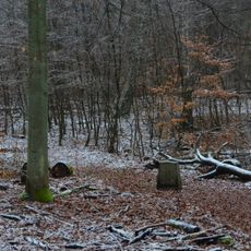
The site is accessible on foot with direct access to the ruins and surrounding structures and foundations. Visitors should be prepared for outdoor conditions and sturdy footwear is recommended for exploring the uneven terrain.

Did you know?

In the late Renaissance, the decaying fortress became the site of a remarkable enterprise when court physician Leonhard Thurneysser established glassworks there from 1571 to 1584. This unusual use of a castle ruin demonstrates how skilled residents found new purposes for historic structures.

Location
Inception
1247
GPS coordinates
52.97820,13.75930
Latest update
December 9, 2025 12:22

AroundUs brings together thousands of curated places, local tips, and hidden gems, enriched daily by 60,000 contributors worldwide. Discover all places nearby (Joachimsthal).

Around this place
Grumsiner Forst/Redernswalde
Germany

Grumsiner Forst/Redernswalde

5.5 km
Holy Cross church Joachimsthal
Germany

Holy Cross church Joachimsthal

1.1 km
Biorama Project
Germany

Biorama Project

828 m
Village church Altkünkendorf
Germany

Village church Altkünkendorf

8.5 km
Kienhorst/Köllnseen/Eichheide
Germany

Kienhorst/Köllnseen/Eichheide

6 km
Village church Golzow (Barnim)
Germany

Village church Golzow (Barnim)

8.1 km
St. Michaeliskirche
Germany

St. Michaeliskirche

6.6 km
Großer Lubowsee
Germany

Großer Lubowsee

1.9 km
Dorfkirche Glambeck
Germany

Dorfkirche Glambeck

6.6 km
Dorfkirche Parlow
Germany

Dorfkirche Parlow

5.2 km
Sperlingsherberge
Germany

Sperlingsherberge

6.9 km
Jüdischer Friedhof
Germany

Jüdischer Friedhof

1.2 km
Village church Althüttendorf
Germany

Village church Althüttendorf

3.6 km
Dorfkirche
Germany

Dorfkirche

8.4 km
Landschaftsschutzgebiet Biosphärenreservat Schorfheide-Chorin
Germany

Landschaftsschutzgebiet Biosphärenreservat Schorfheide-Chorin

4.3 km
Stolperstein dedicated to Helmuth Chaim
Germany

Stolperstein dedicated to Helmuth Chaim

1.1 km
Kienhorst/Köllnseen/Eichheide
Germany

Kienhorst/Köllnseen/Eichheide

8.7 km
Naturdenkmal Blockpackung bei Ausbau „Sperlingsherberge“ in Groß-Ziethen
Germany

Naturdenkmal Blockpackung bei Ausbau „Sperlingsherberge“ in Groß-Ziethen

6.7 km
War memorial Golzow (Barnim)
Germany

War memorial Golzow (Barnim)

8.3 km
Natural monument English oak on the south side of the cemetery on Zorndorfer Straße
Germany

Natural monument English oak on the south side of the cemetery on Zorndorfer Straße

1.5 km
Naturdenkmal Stiel-Eiche am Wohnblock Grimnitzer Straße 11b in Joachimsthal
Germany

Naturdenkmal Stiel-Eiche am Wohnblock Grimnitzer Straße 11b in Joachimsthal

143 m
Naturdenkmal Stiel-Eiche Töpferstraße auf einem Straßendreieck in Joachimsthal
Germany

Naturdenkmal Stiel-Eiche Töpferstraße auf einem Straßendreieck in Joachimsthal

430 m
Naturdenkmal Stiel-Eiche vor Grimnitzer Straße Nr. 10, westlich der Grundstückszufahrt in Joachimsthal
Germany

Naturdenkmal Stiel-Eiche vor Grimnitzer Straße Nr. 10, westlich der Grundstückszufahrt in Joachimsthal

84 m
Naturdenkmal Trauben-Eiche 300 m nördlich der Försterei Lindhorst, rechts am Weg in Joachimsthal
Germany

Naturdenkmal Trauben-Eiche 300 m nördlich der Försterei Lindhorst, rechts am Weg in Joachimsthal

5.8 km
Stolperstein dedicated to Regina Chaim
Germany

Stolperstein dedicated to Regina Chaim

1.1 km
Grumsiner Forst/Redernswalde
Germany

Grumsiner Forst/Redernswalde

7 km
Gedenkstein Königseiche
Germany

Gedenkstein Königseiche

8.5 km
Werbellinkanal
Germany

Werbellinkanal

6.7 km
Show the full map
« Burg Grimnitz - Medieval castle ruin in Joachimsthal, Germany » is provided by Around Us (aroundus.com). Images and texts are derived from Wikimedia project under a Creative Commons license. You are allowed to copy, distribute, and modify copies of this page, under the conditions set by the license, as long as this note is clearly visible.

Discover hidden gems everywhere you go!

From secret cafés to breathtaking viewpoints, skip the crowded tourist spots and find places that match your style. Our app makes it easy with voice search, smart filtering, route optimization, and insider tips from travelers worldwide. Download now for the complete mobile experience.

Around Us App Screenshot

A unique approach to discovering new places

Le Figaro

All the places worth exploring

France Info

A tailor-made excursion in just a few clicks

20 Minutes

Around Us
Travel Guide & Maps
Download

Send to your phone

QR Code
1

Open the camera app on your mobile.

2

Point at the QR code with your camera. A notification will appear.

3

Tap the notification to open the link.