Kniel, Mountain summit in Oschersleben, Germany.
Description
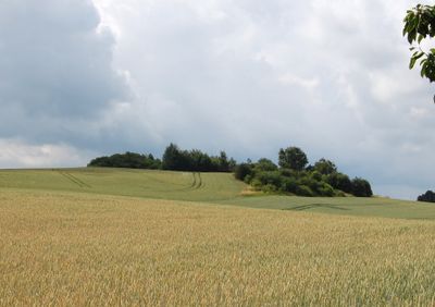
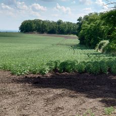
Kniel is a mountain summit in Oschersleben that rises 205 meters above sea level and forms part of the Druxberger Hill Chain in Sachsen-Anhalt. The eastern slope of this peak marks the western boundary of the Magdeburger Börde agricultural plain.
History
A surveying tower stood at the summit until the 1960s, functioning as a trigonometric point for regional mapping. This made the peak an essential part of geographical measurements across the Börde region during the 20th century.
Culture
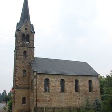
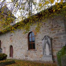
The summit serves as a natural landmark that helps locals orient themselves across the flat surrounding region. People have long used this elevated point as a gathering spot and reference marker in the landscape.
Practical
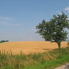
Several hiking paths lead upward from Oschersleben toward the summit, passing through farmland and natural terrain. The routes are easily accessible on foot and offer varying levels of climb depending on which path you choose.
Did you know?
The peak rises noticeably above the surrounding flat landscape, offering wide views across the entire Magdeburger Börde from the top. This outlook stands out because the surrounding region is otherwise very flat and uniform.
AroundUs brings together thousands of curated places, local tips, and hidden gems, enriched daily by 60,000 contributors worldwide. Discover all places nearby (Oschersleben).
Oschersleben
4.6 km
Burg Oschersleben
5.3 km
Schloss Ampfurth
3.6 km
Hubertushöhe
4 km
Amtsgericht Oschersleben
4.9 km
St. Paulskirche Seehausen
4.6 km
Götterstein von Seehausen
4 km
Christuskirche
3.6 km
Rathaus Oschersleben
5 km
Sankt Mariae (Oschersleben)
5.2 km
St. Norbert
2.5 km
Peseckendorfer Warte
4.4 km
St. Nicolai (Oschersleben)
5 km
Gartenstraße 36 (Oschersleben)
4.9 km
Turnhalle Petersilienstraße
5 km
Gartenstraße 43, 44 (Oschersleben)
4.9 km
St. Stephanus
1.9 km
Gartenstraße 37 (Oschersleben)
4.9 km
Berliner Straße 21–23, Magdeburger Straße 30
4.7 km
Alte Dorfstraße 10, 18, 21
5.2 km
Gartenstraße 5 (Oschersleben)
4.9 km
Petersilienstraße 2 (Oschersleben)
5 km
Protestant Church (Altbrandsleben)
987 m
Spitze Berge
4.1 km
Hohes Holz, Saures Holz mit östlichem Vorland
2.1 km
Protestant Church Eggenstedt
4.4 km
Protestant Church Seehausen
4.3 km
Seehäuser Warte
5.4 kmDiscover hidden gems everywhere you go!
From secret cafés to breathtaking viewpoints, skip the crowded tourist spots and find places that match your style. Our app makes it easy with voice search, smart filtering, route optimization, and insider tips from travelers worldwide. Download now for the complete mobile experience.
A unique approach to discovering new places❞
— Le Figaro
All the places worth exploring❞
— France Info
A tailor-made excursion in just a few clicks❞
— 20 Minutes