Enable Location

We need your location to show you interesting places around you

Discover nearby places

Find interesting locations and hidden gems around you

Precise directions

Get accurate directions and distances to places

Your location is never shared with other users. It's only used when you tap the location button.

Dengelstein

Log in to your account

Start exploring — it's free

Trusted by 62,036 travelers worldwide

Continue with Google
Continue with Apple
or

We will send you a code to connect

By continuing, you accept our Terms and Conditions and our Privacy Policy

Check your inbox

We've sent a pincode in your inbox. Please enter the code below.

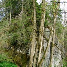
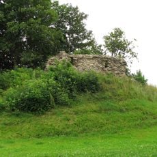
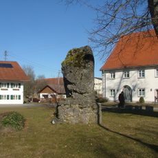
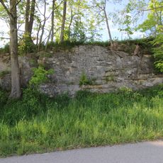
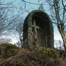
Dengelstein, Natural monument and geotope in Durach, Germany

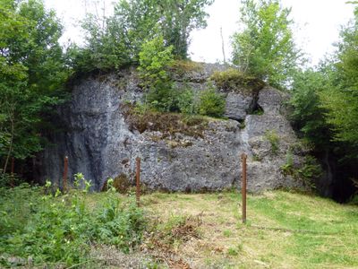
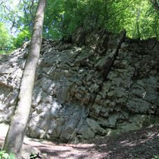
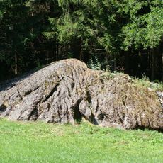
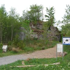
The Dengelstein is a glacial erratic boulder located in the Kempten Forest near Durach in Bavaria. This natural monument rises prominently from the forest floor and is protected as both a geotope and natural heritage site.

During the last ice age, roughly 18,000 years ago, the Iller glacier carried this boulder from Rottachberg mountain and deposited it at its current location. Such long-distance transport by glacial ice created these scattered boulders across the landscape.

Local traditions suggest that the site served as a Celtic ceremonial ground where horses were offered as sacrifices, though no archaeological evidence supports this claim.

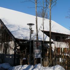
The boulder is accessible on foot via forest trails marked from Durach, though the paths can become slippery after rain. The site is free to visit and open year-round without restrictions.

Local folklore claims that the devil sharpens his scythe on this stone before calamity strikes, which is the origin of its name. This old tale has kept the boulder embedded in regional legend for centuries.

The community of curious travelers

AroundUs brings together thousands of curated places, local tips, and hidden gems, enriched daily by 60,000 contributors worldwide.

Start exploring
Location
Elevation above the sea
859 m
Length
19 m
Width
14 m
Part of
Cultural heritage D-7-8228-0022 in Durach
GPS coordinates
47.71030,10.40610
Latest update
December 10, 2025 20:02
« Dengelstein - Natural monument and geotope in Durach, Germany » is provided by Around Us (aroundus.com). Images and texts are derived from Wikimedia project under a Creative Commons license. You are allowed to copy, distribute, and modify copies of this page, under the conditions set by the license, as long as this note is clearly visible.

Discover hidden gems everywhere you go!

From secret cafés to breathtaking viewpoints, skip the crowded tourist spots and find places that match your style. Our app makes it easy with voice search, smart filtering, route optimization, and insider tips from travelers worldwide. Download now for the complete mobile experience.

Around Us App Screenshot

A unique approach to discovering new places

Le Figaro

All the places worth exploring

France Info

A tailor-made excursion in just a few clicks

20 Minutes

Around Us
Travel Guide & Maps
Download

Send to your phone

QR Code
1

Open the camera app on your mobile.

2

Point at the QR code with your camera. A notification will appear.

3

Tap the notification to open the link.