Strohmberg

Log in to your account

AroundUs is a community-driven map of interesting places, built by curious explorers like you. It grows with every review, story, and photo you share.
Connect to save your favorite spots, contribute locations, and create personalized routes.
Continue with Google
Continue with Apple
Continue with X
Continue with Facebook
Continue with email
By continuing, you accept our Terms and Conditions and our Privacy Policy
Create an account

Strohmberg

Add to collection
Map
Suggest a change
Share

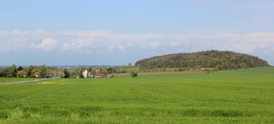
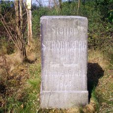
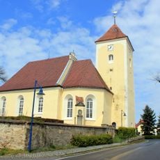
Strohmberg, Mountain summit in Bautzen District, Germany.

Strohmberg is a mountain summit in Upper Lusatia that rises to 264 meters and features multiple natural trails through varied rock formations and wooded slopes. The terrain displays diverse geological layers and exposed cliff faces along the paths.

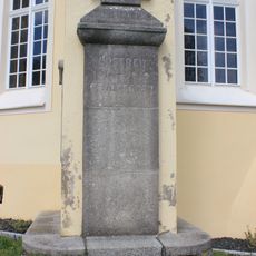
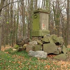
The mountain was used for basalt mining during the industrial period, supplying important building materials to the Saxony region. This mining activity shaped the landscape and left visible traces on the terrain.

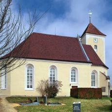
The mountain carries both German and Sorbian names, reflecting the shared heritage of Upper Lusatia where different language communities have lived together for centuries. Visitors can notice this cultural mix in the names of surrounding villages and paths.

The summit is reachable from several nearby villages, with trails of varying difficulty connecting from different starting points. Good footwear is recommended as some paths can be steep and rocky in sections.

The mountain contains rare minerals including albite, anorthite, augite, and nepheline, making it interesting for mineral collectors and rock enthusiasts. These mineral deposits are not common in the region and attract specialized visitors.

Location: Bautzen District

Elevation above the sea: 264 m

GPS coordinates: 51.17559,14.65483

Latest update: December 14, 2025 18:40

Photos
Around this place
Kirche Nostitz
Germany

Kirche Nostitz

2 km
Wohnhaus Ernst-Thälmann-Straße 20
Germany

Wohnhaus Ernst-Thälmann-Straße 20

2.4 km
Marktbrunnen
Germany

Marktbrunnen

2.4 km
Wasserturm Weißenberg
Germany

Wasserturm Weißenberg

2.4 km
Rathaus Weißenberg
Germany

Rathaus Weißenberg

2.4 km
Alte Lohgerberei; Villa mit Einfriedung und Gerberei mit Dampfmaschine Wasserstraße 1, 1a
Germany

Alte Lohgerberei; Villa mit Einfriedung und Gerberei mit Dampfmaschine Wasserstraße 1, 1a

2.2 km
Kirchschule Weißenberg
Germany

Kirchschule Weißenberg

2.4 km
Station 47 Strohmberg
Germany

Station 47 Strohmberg

18 m
Kirche Weißenberg
Germany

Kirche Weißenberg

2.3 km
Wohnhaus und Nebengebäude Brauhausstraße 10
Germany

Wohnhaus und Nebengebäude Brauhausstraße 10

2.2 km
Weißenberg, August-Bebel-Platz 11
Germany

Weißenberg, August-Bebel-Platz 11

2.4 km
Gefallenendenkmal Nostitz/Nosaćicy
Germany

Gefallenendenkmal Nostitz/Nosaćicy

2 km
Gedenkstein (im Wald bei Nostitz)
Germany

Gedenkstein (im Wald bei Nostitz)

1.2 km
Lutherstein Nostitz 40 (neben)
Germany

Lutherstein Nostitz 40 (neben)

2 km
Alte Pfefferküchlerei
Germany

Alte Pfefferküchlerei

2.4 km
Friedhofshalle Jan-Kilian-Straße (auf dem Friedhof)
Germany

Friedhofshalle Jan-Kilian-Straße (auf dem Friedhof)

2.4 km
Herrenhaus des Rittergutes Särka 1
Germany

Herrenhaus des Rittergutes Särka 1

1.4 km
Schloss Nostitz
Germany

Schloss Nostitz

1.9 km
Obermühle Weißenberg
Germany

Obermühle Weißenberg

2.2 km
Church Nostitz
Germany

Church Nostitz

2 km
Wohnhaus in Ecklage und in halboffener Bebauung Ernst-Thälmann-Straße 5
Germany

Wohnhaus in Ecklage und in halboffener Bebauung Ernst-Thälmann-Straße 5

2.4 km
Rittergut Nostitz; Herrenhaus (Nr. 5), vier Wirtschaftsgebäude (Nr. 3, 4, 5a, 6) und südliche Gutsscheune des ehem Rittergutes Nostitz Nostitz 3, 4, 5, 5a, 6
Germany

Rittergut Nostitz; Herrenhaus (Nr. 5), vier Wirtschaftsgebäude (Nr. 3, 4, 5a, 6) und südliche Gutsscheune des ehem Rittergutes Nostitz Nostitz 3, 4, 5, 5a, 6

1.7 km
Gasthof in geschlossener Bebauung August-Bebel-Platz 10
Germany

Gasthof in geschlossener Bebauung August-Bebel-Platz 10

2.4 km
Wohnhaus Mühlbergstraße 10
Germany

Wohnhaus Mühlbergstraße 10

2.4 km
Sowjetischer Ehrenfriedhof (Sachgesamtheit) Pestalozziplatz
Germany

Sowjetischer Ehrenfriedhof (Sachgesamtheit) Pestalozziplatz

2.4 km
Wohnhaus in geschlossener Bebauung August-Bebel-Platz 13
Germany

Wohnhaus in geschlossener Bebauung August-Bebel-Platz 13

2.4 km
Wohnhaus Mühlbergstraße 19
Germany

Wohnhaus Mühlbergstraße 19

2.4 km
Schützenhaus; Gasthof mit Saalanbau Reichenbacher Straße 1
Germany

Schützenhaus; Gasthof mit Saalanbau Reichenbacher Straße 1

2.4 km
Show the full map
Reviews

Visited this place? Tap the stars to rate it and share your experience / photos with the community! Try now! You can cancel it anytime.

« Strohmberg - Mountain summit in Bautzen District, Germany » is provided by Around Us (aroundus.com). Images and texts are derived from Wikimedia project under a Creative Commons license. You are allowed to copy, distribute, and modify copies of this page, under the conditions set by the license, as long as this note is clearly visible.

Discover hidden gems everywhere you go!

From secret cafés to breathtaking viewpoints, skip the crowded tourist spots and find places that match your style. Our app makes it easy with voice search, smart filtering, route optimization, and insider tips from travelers worldwide. Download now for the complete mobile experience.

Around Us App Screenshot

A unique approach to discovering new places

Le Figaro

All the places worth exploring

France Info

A tailor-made excursion in just a few clicks

20 Minutes