Enable Location

We need your location to show you interesting places around you

Discover nearby places

Find interesting locations and hidden gems around you

Precise directions

Get accurate directions and distances to places

Your location is never shared with other users. It's only used when you tap the location button.

Monte Troodelöh

Log in to your account

Start exploring — it's free

Trusted by 61,371 travelers worldwide

Continue with Google
Continue with Apple
or

We will send you a code to connect

By continuing, you accept our Terms and Conditions and our Privacy Policy

Check your inbox

We've sent a pincode in your inbox. Please enter the code below.

Monte Troodelöh

Monte Troodelöh, Summit in Rath/Heumar district, Germany.

Description

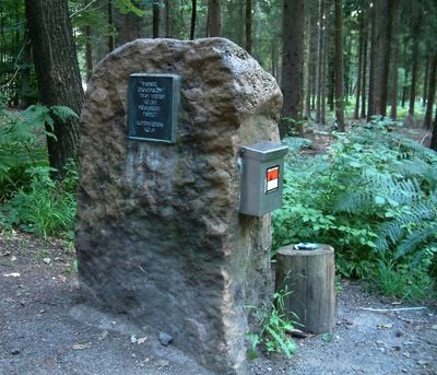
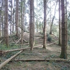
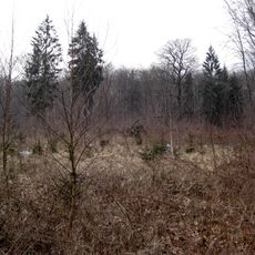
Monte Troodelöh rises 118 meters above sea level and is the highest point within Cologne's city boundaries, located between Pionier-Hütten-Weg and Brück-Forsbacher Weg. The hill is marked by a distinctive boulder with a bronze plaque and welcomes hikers to climb the short route to the summit.

History

The hill remained undocumented until 1999, when city employees recognized its significance and installed a temporary summit cross. An official height measurement took place in 2000, establishing it as the city's acknowledged highest point.

Culture

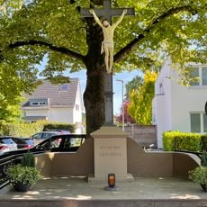
A boulder with a bronze plaque marks the summit, replacing an earlier cross, while a traditional summit register invites visitors to record their ascents. The location holds symbolic meaning for hikers as the city's highest point.

Practical

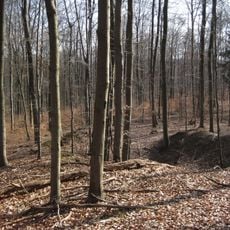
The Wolfsweg trail provides direct access to the summit and connects with multiple hiking routes through the Königsforst. The climb is brief and straightforward, manageable for casual hikers.

Did you know?

The name combines the surnames of three city employees - Troost, Dedden, and Löhmer - who brought attention to the hill through an employee newspaper competition. This unusual naming shows how a local everyday project became a city-wide landmark.

Location
Elevation above the sea
118.04 m
GPS coordinates
50.93867,7.14188
Latest update
December 7, 2025 20:23

AroundUs brings together thousands of curated places, local tips, and hidden gems, enriched daily by 60,000 contributors worldwide. Discover all places nearby (Rath/Heumar).

« Monte Troodelöh - Summit in Rath/Heumar district, Germany » is provided by Around Us (aroundus.com). Images and texts are derived from Wikimedia project under a Creative Commons license. You are allowed to copy, distribute, and modify copies of this page, under the conditions set by the license, as long as this note is clearly visible.

Discover hidden gems everywhere you go!

From secret cafés to breathtaking viewpoints, skip the crowded tourist spots and find places that match your style. Our app makes it easy with voice search, smart filtering, route optimization, and insider tips from travelers worldwide. Download now for the complete mobile experience.

Around Us App Screenshot

A unique approach to discovering new places

Le Figaro

All the places worth exploring

France Info

A tailor-made excursion in just a few clicks

20 Minutes

Around Us
Travel Guide & Maps
Download

Send to your phone

QR Code
1

Open the camera app on your mobile.

2

Point at the QR code with your camera. A notification will appear.

3

Tap the notification to open the link.