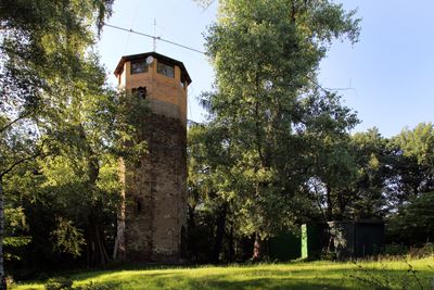
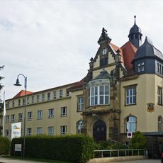
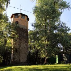
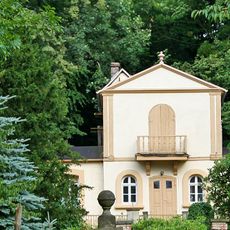
Felixturm, Observation tower in Arnsdorf, Germany
Felixturm is an observation and communication tower in Arnsdorf that combines two functions in a single structure. From its height, it offers views across the surrounding landscape, where forests and residential areas spread out below.
The tower was built as a dual-purpose structure combining observation and communication functions during a period of regional technological development. It marks an era when such buildings played essential roles in Saxony's infrastructure network.
The tower serves as a gathering point where locals appreciate the engineering skill that went into its design. You can sense its importance to the community by observing how people use the space and interact with the landscape around it.
The tower is accessible during daylight hours, and information panels along the way explain the surrounding geography and how the structure works. Plan your visit for clear weather to make the most of the views from above.
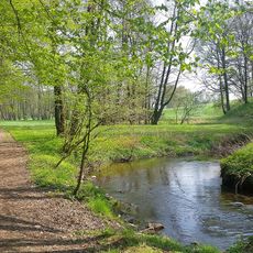
The tower's location gives it a rare vantage point where you can observe both natural forests and human development at once. This position offers visitors a chance to see how the landscape has been shaped by both nature and settlement patterns.
Location: Arnsdorf
GPS coordinates: 51.12116,13.95006
Latest update: December 12, 2025 14:22
Heinrichsthaler Milchwerke
752 m
Schloss Klippenstein
1.7 km
Dorfkirche Wallroda
1 km
Hundestallbrücke
1.7 km
Museum Schloss Klippenstein
1.8 km
Stadtkrankenhaus Radeberg Dr. Paul Kirchner; Asklepios - ASB Klinik Radeberg; Villa (im Portal bezeichnet) ohne Anbau Pulsnitzer Straße 60
1.4 km
Mühlstraße 17
926 m
Mühlstraße 21
917 m
Hüttertal
756 m
Wohnhaus in offener Bebauung mit linkem Seitenflügel Schloßstraße 10
1.8 km
Hüttertal; Scheune, Mühlengebäude und Mühlgraben mit Wehr Schloßstraße 8
1.6 km
Pulsnitzer Straße 46
1.8 km
Station 65 Felixturm
5 m
Zwei Wassereinzugshäuschen Kamenzer Straße
1.5 km
Wohnhaus in offener Bebauung Pulsnitzer Straße 45
1.8 km
Mühlstraße 13
920 m
Mühlstraße 11
925 m
Mühlstraße 7
861 m
Große Hundestallbrücke; Einbogige Sandsteinbrücke über die Röder Schloßstraße
1.7 km
Wohnstallhaus Friedensstraße 6
926 m
Ländliches Wohnhaus in offener Bebauung Schloßstraße 9
1.8 km
Hüttertal (vorderer Teil einschließlich Fachwerkteil), Mühlgraben mit Wehr, Mühlrad und zwei Pfeiler mit Kugelaufsätzen Schloßstraße 21
906 m
Phillipp-Mühle
926 m
Gasthof mit Saal Radeberger Straße 43
1 km
Haus Rödertal (ehemals); Sogenannte Knochenstampe; Wohnhaus im Schweizerhausstil Schloßstraße 20
1 km
Kassenhäuschen und Umkleidekabinen des Stadtbad (Radeberg) Wasserstraße
1.8 km
Langbeinscher Garten mit Gartenhaus; Lustgarten, darin klassizistisches Gartenhaus, kleine Treppenanlage sowie Bruchsteinmauer am Weg und Scheune außerhalb der Einfriedung Schloßstraße 16
1.6 km
Schule Schulberg 3
1 kmVisited this place? Tap the stars to rate it and share your experience / photos with the community! Try now! You can cancel it anytime.
Discover hidden gems everywhere you go!
From secret cafés to breathtaking viewpoints, skip the crowded tourist spots and find places that match your style. Our app makes it easy with voice search, smart filtering, route optimization, and insider tips from travelers worldwide. Download now for the complete mobile experience.
A unique approach to discovering new places❞
— Le Figaro
All the places worth exploring❞
— France Info
A tailor-made excursion in just a few clicks❞
— 20 Minutes