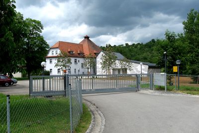
Filderwasserversorgung, Water supply cooperative in Esslingen, Germany
Filderwasserversorgung is a water supply cooperative in Esslingen that serves ten member communities with drinking water. A main pipeline network of about 24 kilometers transports water from Neckartailfingen to Vaihingen, supplying roughly 134,000 people along the way.
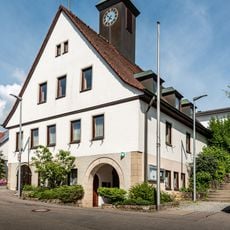
The cooperative was founded in 1904 when eight municipalities joined forces because groundwater in the western region of Esslingen was insufficient. Later, sources from Lake Bodensee were tapped as an additional water supply to meet the growing population's needs.
The water system demonstrates how communities work together to manage a shared resource and ensure daily supply for everyone. This cooperative approach shapes the region's identity as a place where resources are collectively stewarded.
The system works through a combination of local groundwater sources and water from distant lakes, transported through pipelines. Visitors can contact the administration to learn more about the water infrastructure and how it operates.
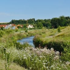
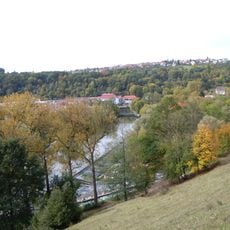
A distinctive feature is an infiltration pipe system about 1,000 meters long that lies hidden within the Neckar River's gravel bed. This natural filter system draws water from the river and harnesses the ground's natural purifying ability.
Location: Esslingen
Inception: 1904
GPS coordinates: 48.61830,9.28500
Latest update: December 14, 2025 16:46
Martinskirche
1.7 km
Naturtheater Grötzingen
1.5 km
Teufelsbrücke
3.3 km
Villa rustica of Nürtingen
3.2 km
Teufelsklinge
3.3 km
Kirche Raidwangen
2.2 km
Stadtmauer Grötzingen
1.7 km
Aichtal mit angrenzenden Gebieten
2.9 km
LSG 'Autmuttal bei Großbettlingen, Geigersbühl und Gewann Gelber Brunnen' (3 Teilgebiete) vom 24.07.1981
3.6 km
LSG 'Neckar-, Erms- und Autmuttal im Verwaltungsraum Neckartenzlingen' (4 Teilgebiete) vom 08.08.1980 geändert am 03.09.1984 und 10.04.1086
3.2 km
Felsengruppe und Wasserfall im Döbelwald
2.4 km
Heide im Gewann Im Steidach
2 km
1 Linde (Lutherlinde)
1.7 km
Feuchtgebiet am Bitzlenbach
2.9 km
Ehemaliger Rhätsandsteinbruch
2.2 km
Seerosenteich
3 km
Felsenblock (Ulrichstein)
2.1 km
17 Linden (Lindenallee)
1.4 km
1 Linde
2.9 km
Hohlweg im Gewann Steidachwiesen
1.9 km
Linde an der Straße nach Wolfschlugen
2.2 km
1 Linde (Schillerlinde)
3 km
Aich mit Insel
2 km
Vulkanembryo Geigersbühl mit 3 Linden
3.5 km
1 Feldhecke
3.3 km
Lindenallee am Schützenhaus
1.2 km
Kleingewässer mit Feldgehölz im Unteren Altgrötzinger Tal
2.5 km
Rathaus Hardt
2.8 kmVisited this place? Tap the stars to rate it and share your experience / photos with the community! Try now! You can cancel it anytime.
Discover hidden gems everywhere you go!
From secret cafés to breathtaking viewpoints, skip the crowded tourist spots and find places that match your style. Our app makes it easy with voice search, smart filtering, route optimization, and insider tips from travelers worldwide. Download now for the complete mobile experience.
A unique approach to discovering new places❞
— Le Figaro
All the places worth exploring❞
— France Info
A tailor-made excursion in just a few clicks❞
— 20 Minutes