Georgenberg, Mountain summit in Pfullingen, Germany
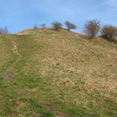
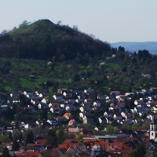
Georgenberg is a 601.7 m high cone-shaped mountain of volcanic origin on the border between Reutlingen and Pfullingen; the summit and most of the mountain lie in Pfullingen. Its summit is a former volcanic vent of the Schwäbische Vulkan, protected as a geotope, and terraced wine-growing structures remain below the top.
Georgenberg is one of about 350 volcanic vents of the Schwäbischer Vulkan, formed by a phreatomagmatic explosion in the Miocene, around 17 million years ago. Its vent contains hard tuff and blocks of White Jurassic limestone, showing that the Jurassic plateau once extended further north. A chapel dedicated to Saint George, first documented in 1489, gave the mountain its name, in use since 1719; before that it was called Echitzenberg.
The mountain's name comes from a St. George's chapel that once stood on the summit, first recorded in 1489; the name Georgenberg has been common since 1719, before which the hill was called Echitzenberg. In 1749 Reutlingen and Pfullingen winegrowers fought the so-called Weinberg-Krieg over the slopes, settled only by Württemberg troops.
The summit can only be reached via a narrow path on the south side of the mountain; the climb from the valley takes about half an hour. There are no other routes to the top.
The slopes still show remnants of old wine cultivation terraces that once supported significant agricultural activity. These historical structures remain visible today and continue to shape the appearance of the mountainside.
The community of curious travelers
AroundUs brings together thousands of curated places, local tips, and hidden gems, enriched daily by 93,976 contributors worldwide.