Chest opened
+${chestReward.xp} XP
Explorer
NOUVEAU ×${chestReward.collectible.quantity}
tapez pour fermer

See the monuments around you in AR Open chests in the app

Around Us is built for your phone — point your camera at the streets and discover the monuments and places around you in augmented reality. Around Us is built for your phone — chests unlock when you walk, explore and capture nearby places.

•

Enable Location

We need your location to show you interesting places around you

Discover nearby places

Find interesting locations and hidden gems around you

Precise directions

Get accurate directions and distances to places

Your location is never shared with other users. It's only used when you tap the location button.

Nibelungensteig

Log in to your account

Start exploring — it's free

Trusted by 94,608 travelers worldwide

Continue with Google
Continue with Apple
or

We will send you a code to connect

By continuing, you accept our Terms and Conditions and our Privacy Policy

Check your inbox

We've sent a pincode in your inbox. Please enter the code below.

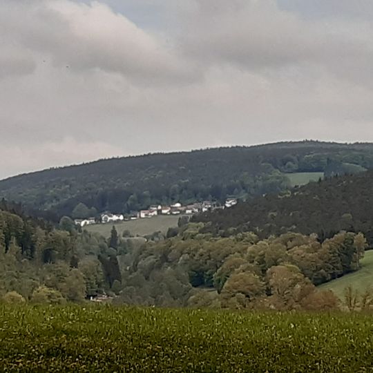
Nibelungensteig, Long-distance hiking trail in Odenwald, Germany.

Nibelungensteig is a long-distance hiking trail through the Odenwald region that runs about 130 kilometers from Zwingenberg to Freudenberg am Main, passing through forests, hills, and valleys. The route crosses three German states and moves through diverse landscapes that shift between dense woodland and open ridge areas.

The trail began in 2008 with an initial section from Zwingenberg to Grasellenbach and was expanded to become a certified quality hiking route by 2012. The regions it connects have been shaped by woodland and upland geology for centuries.

The trail is named after the Nibelung legend, which is closely tied to the Worms region and the Odenwald. Three feeder routes lead from Worms, a central setting of the saga, through the Hessian Ried to the trail: two cycling routes (north and south) and one hiking path. Near Grasellenbach the route passes the Siegfriedbrunnen, the best known of the Odenwald springs where Siegfried was supposedly killed by Hagen.

The trail is waymarked throughout with a red N on a white background; the three feeder routes from Worms carry a green N on white instead. It is walked in seven stages of roughly 13 to 28 kilometres, and a 28-kilometre variant via Erbach branches off between Hüttenthal and Erbach-Bullau. The first stage from Zwingenberg over the Melibokus to Lindenfels is the hardest, with 1,240 metres of ascent.

The trail's waymark is a red N on a white background; the three feeder routes from Worms, the Nibelungen city, use a green N instead. Since 2008 an ultramarathon of 53 km with about 1,400 m of climbing has been held on the route, usually in autumn.

The community of curious travelers

AroundUs brings together thousands of curated places, local tips, and hidden gems, enriched daily by 94,608 contributors worldwide.
Start exploring
Location
Location
Length
130 km
Reference
Nibelungensteig
Operator
Odenwaldklub e.V.
Address
Nibelungensteig, 64673 Zwingenberg, Germany
GPS coordinates
49.61332,8.92576
Latest update
October 26, 2026 14:14
Reviews
Share your experience

No review yet

Discussions
Start a discussion...

No discussion yet

« Nibelungensteig - Long-distance hiking trail in Odenwald, Germany » is provided by Around Us (aroundus.com). Images and texts are derived from Wikimedia project under a Creative Commons license. You are allowed to copy, distribute, and modify copies of this page, under the conditions set by the license, as long as this note is clearly visible.

Discover hidden gems everywhere you go!

From secret cafés to breathtaking viewpoints, skip the crowded tourist spots and find places that match your style. Our app makes it easy with voice search, smart filtering, route optimization, and insider tips from travelers worldwide. Download now for the complete mobile experience.

Around Us App Screenshot
❝

A unique approach to discovering new places❞

— Le Figaro

❝

All the places worth exploring❞

— France Info

❝

A tailor-made excursion in just a few clicks❞

— 20 Minutes

Around Us
Travel Guide & Maps
Download

Send to your phone

QR Code
1

Open the camera app on your mobile.

2

Point at the QR code with your camera. A notification will appear.

3

Tap the notification to open the link.
