Güttlerbüschl, Mountain summit in Neusalza-Spremberg, Germany
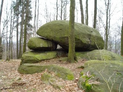
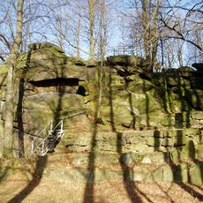
Güttlerbüschl is a mountain summit standing at about 370 meters in the southeastern extension of Hahneberg. The site features deciduous woodland mixed with meadows and fields, along with several prominent granite blocks including a formation known as Thors Amboss.
The granite formations at this site originated during the Neolithic period, roughly between 5500 and 2200 BC. During that era, farming communities and livestock herders inhabited Upper Lusatia and established settlements across its elevated terrain.
The granite blocks here are part of a mysterious group of sites in Upper Lusatia that have occupied people across generations. Visitors can examine these natural formations and draw their own conclusions about what role they may have played in ancient times.
Access to the summit is on foot across private property, so permission or a guided tour is necessary. Visitors should wear appropriate clothing for outdoor conditions, as weather can change quickly at elevated locations.
A distinctive rock configuration called Thors Amboss sets this location apart from other elevated spots in the region. This unusual stone formation is often overlooked by visitors despite being one of the summit's most defining features.
The community of curious travelers
AroundUs brings together thousands of curated places, local tips, and hidden gems, enriched daily by 60,000 contributors worldwide.