Enable Location

We need your location to show you interesting places around you

Discover nearby places

Find interesting locations and hidden gems around you

Precise directions

Get accurate directions and distances to places

Your location is never shared with other users. It's only used when you tap the location button.

Lerchenberg

Log in to your account

Start exploring — it's free

Trusted by 62,903 travelers worldwide

Continue with Google
Continue with Apple
or

We will send you a code to connect

By continuing, you accept our Terms and Conditions and our Privacy Policy

Check your inbox

We've sent a pincode in your inbox. Please enter the code below.

Lerchenberg
Discussion Reviews 1 Photos
1.7k Popularity

Lerchenberg, Mountain summit in Bannewitz, Germany

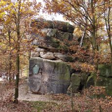
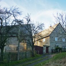
Lerchenberg is a mountain summit in Bannewitz rising to 425 meters, characterized by exposed gneiss rock formations on its northern slopes. The terrain shifts between forested sections and open areas that create varied viewpoints across the ridge.

The gneiss formation developed during the Rotliegend era and sits as part of the Döhlener Basin's geological structure. Extensive gneiss conglomerate deposits shaped this landscape region over millions of years.

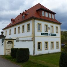
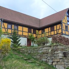
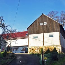
Local residents frequently gather at the mountain inn located at the summit to share meals while observing the surrounding Erzgebirge landscape.

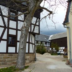
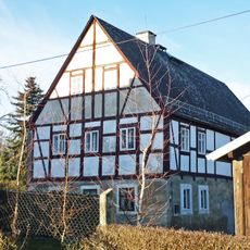
The summit is accessible via several routes, including a paved road from Börnchen and walking trails starting from the village of Oelsa. A mountain inn at the top offers rest and refreshments for those making the ascent.

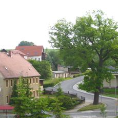
The ridge provides sweeping views across multiple landscape layers, with Dresden's silhouette at the horizon and the Osterzgebirge peaks standing out to the south. On clear days, distinctive landmarks like Windberg and Babisnauer Pappel become distinguishable across the distant terrain.

The community of curious travelers

AroundUs brings together thousands of curated places, local tips, and hidden gems, enriched daily by 60,000 contributors worldwide.

Start exploring
Location
Location
Elevation above the sea
425 m
GPS coordinates
50.95669,13.68322
Latest update
December 14, 2025 13:07
Around this place
Dorfkirche Possendorf
Germany

Dorfkirche Possendorf

2.2 km
Götzenbüschchen
Germany

Götzenbüschchen

2.1 km
Dorfkirche Oelsa
Germany

Dorfkirche Oelsa

1.3 km
Schill-Gut Ferdinand-von-Schill-Straße 4 Wilmsdorf
Germany

Schill-Gut Ferdinand-von-Schill-Straße 4 Wilmsdorf

2.2 km
Kirche mit angebautem Gemeindehaus und Pfarrhaus, dazu Grünanlage (Gartendenkmal) mit Fußgängerbrücke über den Oelsabach, Treppenaufgang, terrassiertem Gelände und wertvollem Gehölzbestand Pfarrweg 2
Germany

Kirche mit angebautem Gemeindehaus und Pfarrhaus, dazu Grünanlage (Gartendenkmal) mit Fußgängerbrücke über den Oelsabach, Treppenaufgang, terrassiertem Gelände und wertvollem Gehölzbestand Pfarrweg 2

1.3 km
Einzeldenkmal der Sachgesamtheit Friedhof und Kapelle Possendorf: Friedhofskapelle (siehe auch Sachgesamtheitsliste - Obj. 09301435, gleiche Anschrift) Hauptstraße -
Germany

Einzeldenkmal der Sachgesamtheit Friedhof und Kapelle Possendorf: Friedhofskapelle (siehe auch Sachgesamtheitsliste - Obj. 09301435, gleiche Anschrift) Hauptstraße -

2 km
Königlich-Sächsische Meilensteine (Sachgesamtheit) Possendorf
Germany

Königlich-Sächsische Meilensteine (Sachgesamtheit) Possendorf

2.1 km
Schule Hauptstraße 71
Germany

Schule Hauptstraße 71

1.5 km
Pforte Ferdinand-von-Schill-Straße 34 Wilmsdorf
Germany

Pforte Ferdinand-von-Schill-Straße 34 Wilmsdorf

1.9 km
Schill-Denkmal Ferdinand-von-Schill-Straße 4 Wilmsdorf
Germany

Schill-Denkmal Ferdinand-von-Schill-Straße 4 Wilmsdorf

2.2 km
Wohnhaus Curt-Querner-Gasse 4
Germany

Wohnhaus Curt-Querner-Gasse 4

726 m
Wohnstallhaus, Scheune und Auszugshaus eines Dreiseithofes Dorfstraße 56
Germany

Wohnstallhaus, Scheune und Auszugshaus eines Dreiseithofes Dorfstraße 56

840 m
Wohnstallhaus eins Bauernhofes Ferdinand-von-Schill-Straße 56
Germany

Wohnstallhaus eins Bauernhofes Ferdinand-von-Schill-Straße 56

1.7 km
Wohnhaus (ehemals Schule) Hauptstraße 58
Germany

Wohnhaus (ehemals Schule) Hauptstraße 58

1.4 km
Ferdinand-von-Schill-Straße 44 Wilmsdorf
Germany

Ferdinand-von-Schill-Straße 44 Wilmsdorf

1.8 km
Steinkreuz Possendorf
Germany

Steinkreuz Possendorf

2.1 km
Wohnhaus (über hakenförmigem Grundriss) Untere Bergstraße 25
Germany

Wohnhaus (über hakenförmigem Grundriss) Untere Bergstraße 25

2.1 km
Feuerwehr-Gerätehaus Dorfstraße
Germany

Feuerwehr-Gerätehaus Dorfstraße

797 m
Wohnhaus mit integriertem Scheunenteil sowie Felsenkeller Dorfstraße 2
Germany

Wohnhaus mit integriertem Scheunenteil sowie Felsenkeller Dorfstraße 2

1.3 km
Wohnhaus und Scheune eines Zweiseithofes Dorfstraße 47
Germany

Wohnhaus und Scheune eines Zweiseithofes Dorfstraße 47

616 m
Distanzstein
Germany

Distanzstein

1.9 km
Pfarrhaus und zwei Seitengebäude des Pfarrhofes Kirchgasse 2
Germany

Pfarrhaus und zwei Seitengebäude des Pfarrhofes Kirchgasse 2

2.2 km
Wohnstallhaus und ein Seitengebäude eines Vierseithofes Dorfstraße 74
Germany

Wohnstallhaus und ein Seitengebäude eines Vierseithofes Dorfstraße 74

1.5 km
Wohnstallhaus eines Bauernhofes Curt-Querner-Gasse 10
Germany

Wohnstallhaus eines Bauernhofes Curt-Querner-Gasse 10

648 m
Toranlage eines Bauernhofes Dorfstraße 53
Germany

Toranlage eines Bauernhofes Dorfstraße 53

755 m
Scheune eines Dreiseithofes Dorfstraße 59
Germany

Scheune eines Dreiseithofes Dorfstraße 59

912 m
Wohnstallhaus und Stallscheune eines Bauernhofes Curt-Querner-Gasse 1
Germany

Wohnstallhaus und Stallscheune eines Bauernhofes Curt-Querner-Gasse 1

762 m
Kantorat Kirchgasse 4
Germany

Kantorat Kirchgasse 4

2.2 km
Show the full map
Reviews
Share your experience

No review yet

Discussions
Start a discussion...

No discussion yet

« Lerchenberg - Mountain summit in Bannewitz, Germany » is provided by Around Us (aroundus.com). Images and texts are derived from Wikimedia project under a Creative Commons license. You are allowed to copy, distribute, and modify copies of this page, under the conditions set by the license, as long as this note is clearly visible.

Discover hidden gems everywhere you go!

From secret cafés to breathtaking viewpoints, skip the crowded tourist spots and find places that match your style. Our app makes it easy with voice search, smart filtering, route optimization, and insider tips from travelers worldwide. Download now for the complete mobile experience.

Around Us App Screenshot

A unique approach to discovering new places

Le Figaro

All the places worth exploring

France Info

A tailor-made excursion in just a few clicks

20 Minutes

Around Us
Travel Guide & Maps
Download

Send to your phone

QR Code
1

Open the camera app on your mobile.

2

Point at the QR code with your camera. A notification will appear.

3

Tap the notification to open the link.