Helpt Hills, Moraine summit in Mecklenburgische Seenplatte District, Germany
Helpt Hills is a moraine ridge in the Mecklenburg lake region that stretches from southwest to northeast and forms the highest natural point in Mecklenburg-Vorpommern. The formation creates a pronounced rise in an otherwise flat landscape.
These terminal moraines formed during the final ice age when glaciers shaped the landscape, creating the ridge that exists today. The name comes from the village of Helpt located on the northern slopes.
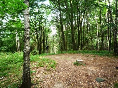
The hills serve as a gathering point for regional hikers who come to enjoy expansive views across lakes and forests on clear days. The summit cross on Helpter Berg is a familiar landmark for people living in the surrounding area.
A network of hiking trails of varying difficulty winds through the hills for visitors to explore on foot. Weather-appropriate gear is helpful, especially if you plan to spend time on the open sections at higher elevations.
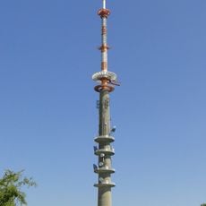
A television transmission tower rising 155 meters stands near the summit, blending modern infrastructure with the natural geology. This striking structure has been visible across the landscape for decades.
Location: Mecklenburgische Seenplatte District
Elevation above the sea: 179.2 m
GPS coordinates: 53.48663,13.60925
Latest update: December 10, 2025 16:01
Helpterberg radio tower
571 m
Burg Blankenburg
5.6 km
Church in Wolfshagen
6 km
St.-Petri-Kirche
3.5 km
Village church Hetzdorf (Uckerland)
8.8 km
Church in Badresch
6.5 km
Church in Helpt
2.4 km
Dorfkirche Lindow
7.9 km
Church in Golm
8.9 km
Church in Holzendorf (Groß Miltzow)
5.8 km
Buddesche Mühle
3.3 km
Ehlertsche Mühle
3.3 km
Dorfkirche Alt Käbelich
7.7 km
City walls in Woldegk
3.3 km
Village church Schlepkow
9 km
Windmühle und Mühlencafè Woldegk
3.3 km
Fröhlckesche Windmühle Woldegk
2.9 km
Gotthunskampmühle Woldegk
3.9 km
Church in Mildenitz
2.5 km
Wasserturm Woldegk
3.2 km
Church in Kreckow
4 km
Lauenhagener See
6.8 km
Mühlenmuseum Woldegk
3.3 km
Stolperstein dedicated to Berthold Wiersch
9.2 km
Stolperstein dedicated to Erich Wiersch
9.2 km
Fischerhaus
5.9 km
Stolperstein dedicated to Siegfried Wiersch
9.2 km
Maria Mutter des Herrn
3.3 kmVisited this place? Tap the stars to rate it and share your experience / photos with the community! Try now! You can cancel it anytime.
Discover hidden gems everywhere you go!
From secret cafés to breathtaking viewpoints, skip the crowded tourist spots and find places that match your style. Our app makes it easy with voice search, smart filtering, route optimization, and insider tips from travelers worldwide. Download now for the complete mobile experience.
A unique approach to discovering new places❞
— Le Figaro
All the places worth exploring❞
— France Info
A tailor-made excursion in just a few clicks❞
— 20 Minutes