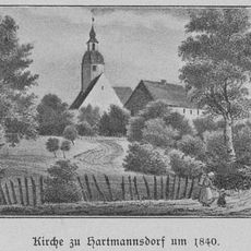
Hirschenstein, Mountain summit in Hartmannsdorf bei Kirchberg, Germany.
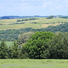
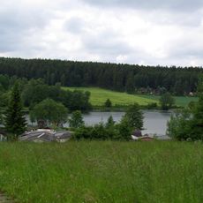
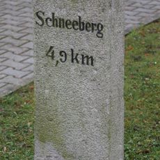
Hirschenstein is a mountain in the Ore Mountains reaching about 610 meters high, forming a visible landmark in the regional landscape. Several marked hiking trails lead up to the summit from surrounding villages in various directions.
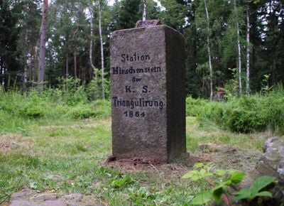
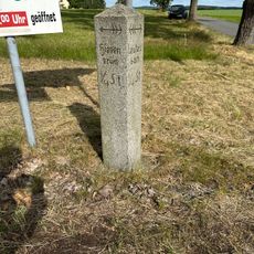
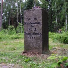
The mountain marked the boundary between different Saxon territories starting in medieval times, serving as a geographic divider for local administration. This role as a border marker shaped regional relationships for centuries.
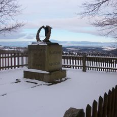
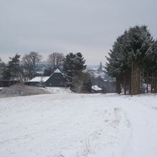
The mountain served as a natural landmark for people living in the surrounding mining regions, who used its distinctive shape to find their way through the mountains. Visitors today can still spot its recognizable outline from many directions.
Hikers should wear sturdy shoes and bring plenty of water, as the mountain is accessible from various sides. The trails are generally well marked, though conditions can vary depending on the season and weather.
On clear days, the summit offers views reaching into both the German lowlands and the neighboring Czech regions. This cross-border perspective makes it a special vantage point for observing two countries from a single location.
Location: Hartmannsdorf bei Kirchberg
Elevation above the sea: 610.4 m
GPS coordinates: 50.59285,12.57244
Latest update: December 14, 2025 20:04
Filzteich
3.3 km
Siebenschlehener Pochwerk
3.7 km
Heide und Moorwald am Filzteich
3.6 km
Kirche (mit Ausstattung), Kirchhof mit Einfriedung und Kriegerdenkmal für die Gefallenen des Ersten Weltkrieges Grüner Platz
3.1 km
Evangelische Pfarrkirche Hartmannsdorf
1.7 km
Oelbachgrund
3.3 km
Forstteich Lindenau
1.7 km
Fabrikbau einer Textilfabrik Auerbacher Straße 166
2.4 km
Filzteich
3.4 km
Muldetal bei Aue
2.5 km
Denkmal St. Anna
3.7 km
Fundgrube Gesellschaft
3.6 km
Schule Schulberg 2
3 km
Transformatorenhäuschen Jacobstraße
3.6 km
Evangelische Pfarrkirche Hartmannsdorf
1.7 km
Daniel Fundgrube
3.5 km
Transformatorenhäuschen Burkersdorfer Straße
3.6 km
Wegestein Weißbach
2.6 km
Fundgrube Beust
3.6 km
Fundgrube Sonnenwirbel
3.8 km
Bergbaulandschaft Fürstenberg (Hoher Forst) (Sachgesamtheit) Hartmannsdorf b. Kirchberg
2.9 km
Wegestein Hartmannsdorf b. Kirchberg
2.9 km
Transformatorenturm Leutersbach
3.7 km
Station 136 Hirschenstein
9 m
Siebenschlehen
3.7 km
Mundloch von Engländerstolln
3.3 km
Gemeindeamt Badstraße 1
1.8 km
Fundgrube Daniel; Schneeberger Revier (Sachgesamtheit) Schneeberg
3.5 kmVisited this place? Tap the stars to rate it and share your experience / photos with the community! Try now! You can cancel it anytime.
Discover hidden gems everywhere you go!
From secret cafés to breathtaking viewpoints, skip the crowded tourist spots and find places that match your style. Our app makes it easy with voice search, smart filtering, route optimization, and insider tips from travelers worldwide. Download now for the complete mobile experience.
A unique approach to discovering new places❞
— Le Figaro
All the places worth exploring❞
— France Info
A tailor-made excursion in just a few clicks❞
— 20 Minutes