Königs Wusterhausen Central Tower, Communications tower in Königs Wusterhausen, Germany.
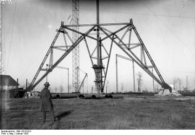
Königs Wusterhausen Central Tower was a steel framework structure with a triangular cross-section that rose 243 meters high. It contained an elevator system that carried technicians to a platform at 230 meters, where they could access six antenna masts mounted on the tower.
The structure was built between 1924 and 1925 to serve as Germany's primary radio transmission facility. It remained in operation until it was destroyed during the severe storm Quimburga in 1972.
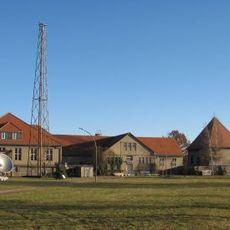
Locals nicknamed the structure 'der Dicke' and it became so central to the town's identity that it was incorporated into Königs Wusterhausen's municipal coat of arms. This reflects how deeply the tower was woven into the community's self-image.
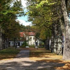
The site was not easily accessible to the public, as it stood on restricted grounds that housed mostly technicians and authorized personnel. Visitors could view the distinctive silhouette from various points around town.
Plans existed to extend the structure to 283 meters, but the Treaty of Versailles prevented this expansion. Despite this restriction, it remained one of the tallest constructions of its era.
Location: Königs Wusterhausen
Height: 243 m
GPS coordinates: 52.30410,13.61110
Latest update: December 12, 2025 14:23
Schloss Königs Wusterhausen
1.1 km
Funkerberg
401 m
Schloss Schenkendorf
2.9 km
Broadcasting Museum Königs Wusterhausen
654 m
Tiergarten
3.3 km
Amtsgericht Königs Wusterhausen
1.1 km
Holy-Cross church Königs Wusterhausen
1.1 km
St. Elisabethkirche
1.6 km
Königs Wusterhausen Water Tower
541 m
Höllengrund–Pulverberg
3.3 km
Village church Niederlehme
3.1 km
Dorfkirche
4.1 km
Wüstemark
3.8 km
Friedenskirche
1.7 km
Dorfkirche Schenkendorf (Mittenwalde)
3 km
Dorfkirche Deutsch Wusterhausen
2 km
Capitol
1.5 km
Dahmeland Museum
1 km
Avenue of large-leaved lime trees in front of the church
1.1 km
Platanus tree 1 (east) by the bridge
1.2 km
Platanus tree 2 (west) by the bridge
1.2 km
Forstweg 49
4.7 km
The 3rd Gleditsia in the avenue to Schenkendorf
2.6 km
Natural monument Quercus robur on the Denkmalplatz corner Dorfstrasse
2 km
World War I memorial Niederlehme
3.1 km
Bergarbeitersiedlung Schenkendorf
3.1 km
Public bookcase Niederlehme
4.5 km
Water tower Niederlehme
2.6 kmVisited this place? Tap the stars to rate it and share your experience / photos with the community! Try now! You can cancel it anytime.
Discover hidden gems everywhere you go!
From secret cafés to breathtaking viewpoints, skip the crowded tourist spots and find places that match your style. Our app makes it easy with voice search, smart filtering, route optimization, and insider tips from travelers worldwide. Download now for the complete mobile experience.
A unique approach to discovering new places❞
— Le Figaro
All the places worth exploring❞
— France Info
A tailor-made excursion in just a few clicks❞
— 20 Minutes