Ottenstein, Mountain summit in Schwarzenberg, Germany
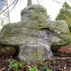
Ottenstein is a mountain in the Schwarzenberg region that stands between the Schwarzwasser and Pöhl rivers in southeastern Saxony. It reaches 474 meters in elevation and displays geological formations that reveal the mineral composition of the Ore Mountains.
The mountain's name comes from Count Otto von Siebeneichen, who established a settlement nearby during medieval times. This early settlement shaped the cultural development of the entire Schwarzenberg area.
The area around the mountain holds a place in local stories as a site of human longing and seclusion. Visitors encounter the legend of a nobleman who withdrew here to live a simple life near the water.
The mountain is easy to reach from the main road between Schwarzenberg and Scheibenberg, with parking available at the base. Access is straightforward and the route is walkable on foot.
The rocks of Ottenstein display visible layers from different geological periods of the Ore Mountains formation. Walkers can observe these natural cuts through Earth's history while climbing.
Location: Schwarzenberg
Elevation above the sea: 474 m
GPS coordinates: 50.54011,12.78782
Latest update: December 14, 2025 18:08
Schwarzenberg Castle
315 m
Waldbühne Schwarzenberg
1.1 km
Saint George Church
305 m
Roter Berg
3.1 km
All Saints church
3.3 km
Eisenbahnmuseum Schwarzenberg
1.2 km
Emmauskirche
2.5 km
Rittergut Sachsenfeld
1.1 km
Christuskirche (Beierfeld)
2.4 km
Graul
2.5 km
Saints Peter and Paul Church
2.3 km
St.-Christophorus-Kirche
3.3 km
Kalkwerk Langenberg
3 km
Hammerbrücke
2.6 km
Knochen
2.4 km
St.-Annen-Kirche
2.3 km
Arbeiterheim Bermsgrün
2.8 km
Mord- und Sühnekreuz Gottfried-Heinrich-Stölzel-Platz 6 (bei)
2.4 km
Kirche mit Ausstattung Obere Schloßstraße 34
315 m
Gedenkstein zur Erinnerung an den Prinzenraub von 1455 Am Fürstenberg 7 (bei)
2.8 km
Royal Saxon Post Milestone in Schwarzenberg/Erzgeb.
469 m
Königseiche
333 m
Linde am Eduardstein
2.3 km
Sachgesamtheit Hammerherrenhof Erla mit folgenden Einzeldenkmalen: Hammerherrenhaus (Nr. 87), drei Seitengebäude (Nr. 85) (siehe Einzeldenkmalliste - Obj. 09269052, gleiche Anschrift) und Gutspark (Gartendenkmal) sowie südwestlicher Verbinderbau, W
2.3 km
Sachgesamtheit Christuskirche (Beierfeld) und Friedhof August-Bebel-Straße 71
2.4 km
Einzeldenkmale der Sachgesamtheit Schloss Schwarzenberg: dreiflügelige Schlossanlage mit südwestlichem Bergfried, westlich angebautem Turmhaus, östlichem Oberhaus (ehemals Palas), südlichem Zwischenbau zum Bergfried, neogotischem Nordbau (Amtsger
356 m
Sachgesamtheit Schloss Schwarzenberg mit folgenden Einzeldenkmalen: dreiflügelige Schlossanlage mit südwestlichem Bergfried, westlich angebautem Turmhaus, östlichem Oberhaus (ehemals Palas), südlichem Zwischenbau zum Bergfried, neogotischem Nordb
356 m
Kreuz-Erfindung-Stolln Hofgarten
330 mVisited this place? Tap the stars to rate it and share your experience / photos with the community! Try now! You can cancel it anytime.
Discover hidden gems everywhere you go!
From secret cafés to breathtaking viewpoints, skip the crowded tourist spots and find places that match your style. Our app makes it easy with voice search, smart filtering, route optimization, and insider tips from travelers worldwide. Download now for the complete mobile experience.
A unique approach to discovering new places❞
— Le Figaro
All the places worth exploring❞
— France Info
A tailor-made excursion in just a few clicks❞
— 20 Minutes