Enable Location

We need your location to show you interesting places around you

Discover nearby places

Find interesting locations and hidden gems around you

Precise directions

Get accurate directions and distances to places

Your location is never shared with other users. It's only used when you tap the location button.

Roter Berg

Log in to your account

Start exploring — it's free

Trusted by 62,377 travelers worldwide

Continue with Google
Continue with Apple
or

We will send you a code to connect

By continuing, you accept our Terms and Conditions and our Privacy Policy

Check your inbox

We've sent a pincode in your inbox. Please enter the code below.

Roter Berg

Roter Berg, Mountain summit in Schneeberg, Germany.

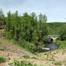
Roter Berg is a summit in Saxony's Ore Mountains that rises to approximately 638 meters (2,093 feet). The mountain displays steep northern slopes and distinctive red soil formations that give it its name.

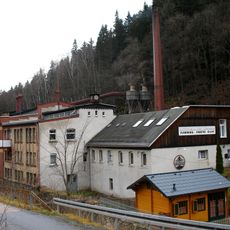
The mountain played a key role in iron ore extraction during the 18th century. Ore from this site supplied foundries across the Schneeberg district.

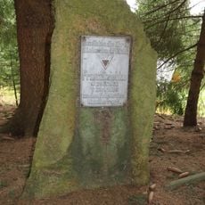
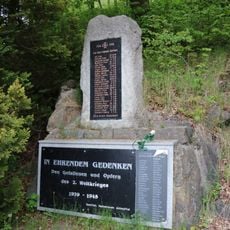
Roter Berg stands as a symbol of Saxon mining heritage, with many local festivals celebrating the historical connection between the mountain and mining communities.

Marked hiking trails to the summit begin from the Schneeberg visitor center and suit intermediate-level hikers. Sturdy footwear and proper mountain gear are recommended for the walk.

The mountain is known for rare mineral deposits such as Schneebergite and Cobalttsumcorite, which were first discovered and documented at this location. These minerals make the site of particular interest to mineral collectors and geologists.

The community of curious travelers

AroundUs brings together thousands of curated places, local tips, and hidden gems, enriched daily by 60,000 contributors worldwide.

Start exploring
Location
Elevation above the sea
637.7 m
Part of
Schneeberg ore district
GPS coordinates
50.51236,12.77922
Latest update
December 14, 2025 20:04
Around this place
Schwarzenberg Castle
Germany

Schwarzenberg Castle

2.8 km
Waldbühne Schwarzenberg
Germany

Waldbühne Schwarzenberg

2.1 km
Saint George Church
Germany

Saint George Church

2.8 km
Wolfsgarten
Germany

Wolfsgarten

2 km
Weiße Frau Schwarzenberg
Germany

Weiße Frau Schwarzenberg

1.9 km
Sanatorium Antonshöhe
Germany

Sanatorium Antonshöhe

1.9 km
Silberwäsche
Germany

Silberwäsche

1.8 km
Arbeiterheim Bermsgrün
Germany

Arbeiterheim Bermsgrün

1.2 km
Lutherkirche
Germany

Lutherkirche

2.9 km
Kirche Crandorf
Germany

Kirche Crandorf

574 m
Polish-Saxon Post Milestone  Breitenbrunn
Germany

Polish-Saxon Post Milestone Breitenbrunn

2.3 km
Methodistenkirche Waldstraße 3
Germany

Methodistenkirche Waldstraße 3

2 km
Gedenkstein für Franz Dziebko
Germany

Gedenkstein für Franz Dziebko

2 km
Kirche mit Ausstattung Obere Schloßstraße 34
Germany

Kirche mit Ausstattung Obere Schloßstraße 34

2.8 km
Linde am Eduardstein
Germany

Linde am Eduardstein

1 km
Königseiche
Germany

Königseiche

2.9 km
Denkmal 1. Weltkrieg Antonsthal
Germany

Denkmal 1. Weltkrieg Antonsthal

1.9 km
Wohnhaus, Seitengebäude und Scheune eines Gutes sowie Hausbaum und Obstgarten (Gartendenkmale) mit Einfriedung Arnoldshammer 5
Germany

Wohnhaus, Seitengebäude und Scheune eines Gutes sowie Hausbaum und Obstgarten (Gartendenkmale) mit Einfriedung Arnoldshammer 5

2.3 km
Sachgesamtheit Hammerherrenhof Erla mit folgenden Einzeldenkmalen: Hammerherrenhaus (Nr. 87), drei Seitengebäude (Nr. 85) (siehe Einzeldenkmalliste - Obj. 09269052, gleiche Anschrift) und Gutspark (Gartendenkmal) sowie südwestlicher Verbinderbau, W
Germany

Sachgesamtheit Hammerherrenhof Erla mit folgenden Einzeldenkmalen: Hammerherrenhaus (Nr. 87), drei Seitengebäude (Nr. 85) (siehe Einzeldenkmalliste - Obj. 09269052, gleiche Anschrift) und Gutspark (Gartendenkmal) sowie südwestlicher Verbinderbau, W

960 m
Einzeldenkmale der Sachgesamtheit Pfeilhammer: ehemaliges Hammerherrenhaus mit südlichem Anbau sowie Einfriedungsmauer (siehe auch Sachgesamtheitsliste - Obj. 09306095) Am Pfeilhammer 5
Germany

Einzeldenkmale der Sachgesamtheit Pfeilhammer: ehemaliges Hammerherrenhaus mit südlichem Anbau sowie Einfriedungsmauer (siehe auch Sachgesamtheitsliste - Obj. 09306095) Am Pfeilhammer 5

2.4 km
Einzeldenkmale der Sachgesamtheit Lutherkirche, Pfarrhaus und Kirchhof Pöhla: Kirche mit angebautem Pfarrhaus, zwei Kriegerdenkmale vor dem Pfarrhaus und Gedenkstein auf dem Friedhof (siehe auch Sachgesamtheitsliste - Obj. 09305996, gleiche Anschrif
Germany

Einzeldenkmale der Sachgesamtheit Lutherkirche, Pfarrhaus und Kirchhof Pöhla: Kirche mit angebautem Pfarrhaus, zwei Kriegerdenkmale vor dem Pfarrhaus und Gedenkstein auf dem Friedhof (siehe auch Sachgesamtheitsliste - Obj. 09305996, gleiche Anschrif

2.8 km
Lutherkirche
Germany

Lutherkirche

2.8 km
Schwarzwassertal und Burkhardtswald
Germany

Schwarzwassertal und Burkhardtswald

2.5 km
Einzeldenkmale der Sachgesamtheit Schloss Schwarzenberg: dreiflügelige Schlossanlage mit südwestlichem Bergfried, westlich angebautem Turmhaus, östlichem Oberhaus (ehemals Palas), südlichem Zwischenbau zum Bergfried, neogotischem Nordbau (Amtsger
Germany

Einzeldenkmale der Sachgesamtheit Schloss Schwarzenberg: dreiflügelige Schlossanlage mit südwestlichem Bergfried, westlich angebautem Turmhaus, östlichem Oberhaus (ehemals Palas), südlichem Zwischenbau zum Bergfried, neogotischem Nordbau (Amtsger

2.8 km
Fabrikgebäude einer Holzwarenfabrik, mit Fabrikschornstein Globenstein 5
Germany

Fabrikgebäude einer Holzwarenfabrik, mit Fabrikschornstein Globenstein 5

2 km
Ehemaliges Erzpochwerk und Erzwäsche, heute Museum und Gaststätte Jägerhäuser Straße 17
Germany

Ehemaliges Erzpochwerk und Erzwäsche, heute Museum und Gaststätte Jägerhäuser Straße 17

1.9 km
Ehemaliges Herrenhaus einer Schmelzhütte, später Teil einer Papierfabrik Jägerhäuser Straße 1
Germany

Ehemaliges Herrenhaus einer Schmelzhütte, später Teil einer Papierfabrik Jägerhäuser Straße 1

2 km
Wettinstein Antonsthal
Germany

Wettinstein Antonsthal

2.7 km
Show the full map
« Roter Berg - Mountain summit in Schneeberg, Germany » is provided by Around Us (aroundus.com). Images and texts are derived from Wikimedia project under a Creative Commons license. You are allowed to copy, distribute, and modify copies of this page, under the conditions set by the license, as long as this note is clearly visible.

Discover hidden gems everywhere you go!

From secret cafés to breathtaking viewpoints, skip the crowded tourist spots and find places that match your style. Our app makes it easy with voice search, smart filtering, route optimization, and insider tips from travelers worldwide. Download now for the complete mobile experience.

Around Us App Screenshot

A unique approach to discovering new places

Le Figaro

All the places worth exploring

France Info

A tailor-made excursion in just a few clicks

20 Minutes

Around Us
Travel Guide & Maps
Download

Send to your phone

QR Code
1

Open the camera app on your mobile.

2

Point at the QR code with your camera. A notification will appear.

3

Tap the notification to open the link.