Enable Location

We need your location to show you interesting places around you

Discover nearby places

Find interesting locations and hidden gems around you

Precise directions

Get accurate directions and distances to places

Your location is never shared with other users. It's only used when you tap the location button.

Radspitze

Log in to your account

Start exploring — it's free

Trusted by 63,102 travelers worldwide

Continue with Google
Continue with Apple
or

We will send you a code to connect

By continuing, you accept our Terms and Conditions and our Privacy Policy

Check your inbox

We've sent a pincode in your inbox. Please enter the code below.

Radspitze
Discussion Reviews 1 Photos
2k Popularity

Radspitze, Mountain summit in Franconian Forest, Bavaria, Germany

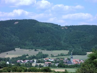
Radspitze is a mountain of approximately 678 meters elevation in the Franconian Forest with dense forest coverage and rocky formations along its slopes. The landscape alternates between forested areas and rocky sections that shape the terrain throughout.

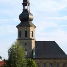
The mountain has served as a reference point for the area since medieval times when the nearby village of Marktrodach was established. This long connection to human settlement makes it an established landmark for the region.

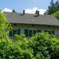
The mountain draws regular visitors from surrounding communities who gather to hike and observe the forest environment. These traditions connect local people to the landscape in a way that shapes how the area is used today.

Marked hiking trails from the village of Marktrodach lead up the mountain and provide good access for visitors of various skill levels. On clear days the routes offer rewarding views across the surrounding Upper Franconia landscape.

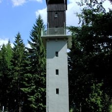
An observation tower sits at the summit offering 360-degree views across Upper Franconia and toward distant mountain ranges. This tower allows visitors to fully grasp the scale of the landscape on clear days.

The community of curious travelers

AroundUs brings together thousands of curated places, local tips, and hidden gems, enriched daily by 60,000 contributors worldwide.

Start exploring
Location
Elevation above the sea
678.4 m
GPS coordinates
50.23488,11.43541
Latest update
December 14, 2025 09:40
Reviews
Share your experience

No review yet

Discussions
Start a discussion...

No discussion yet

« Radspitze - Mountain summit in Franconian Forest, Bavaria, Germany » is provided by Around Us (aroundus.com). Images and texts are derived from Wikimedia project under a Creative Commons license. You are allowed to copy, distribute, and modify copies of this page, under the conditions set by the license, as long as this note is clearly visible.

Discover hidden gems everywhere you go!

From secret cafés to breathtaking viewpoints, skip the crowded tourist spots and find places that match your style. Our app makes it easy with voice search, smart filtering, route optimization, and insider tips from travelers worldwide. Download now for the complete mobile experience.

Around Us App Screenshot

A unique approach to discovering new places

Le Figaro

All the places worth exploring

France Info

A tailor-made excursion in just a few clicks

20 Minutes

Around Us
Travel Guide & Maps
Download

Send to your phone

QR Code
1

Open the camera app on your mobile.

2

Point at the QR code with your camera. A notification will appear.

3

Tap the notification to open the link.