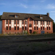
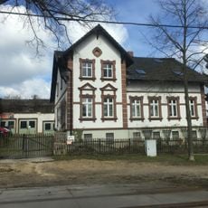
Rangierbahnhof Schlauroth, Classification yard in Görlitz, Germany.
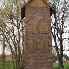
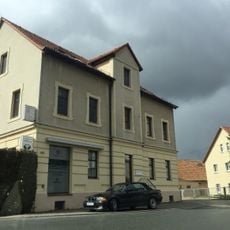
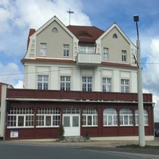
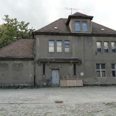
The railway station consists of multiple track groups with designated operational zones for efficient freight movement and logistics operations.
The facility opened in November 1909 after extensive construction efforts to address transportation needs in the growing industrial region of Görlitz.
The station complex included separate administrative offices for Prussian and Saxon railways, reflecting the dual railway authority system of the period.
The station operated continuously until January 1994, when the last freight train processed through its classification tracks before permanent closure.
Located at 232.8 meters above sea level, the station grounds were purchased by Görlitz municipality in 2012 for industrial zone development.
Location: Görlitz
Inception: 1909
Official opening: November 1909
Elevation above the sea: 232.8 m
GPS coordinates: 51.15010,14.93350
Latest update: April 8, 2025 01:37
Landeskrone
2.3 km
Biesnitz
2.3 km
Rauschwalde
1.3 km
Bahnbetriebswerk Görlitz
2.1 km
St. Hedwig
735 m
Helenenbad (Görlitz)
1.8 km
Christuskirche (Görlitz)
1 km
Versuchsanlage Schlauroth
405 m
Hohenzollernburg; Gasthof mit Saal und Turm Promenadenstraße 60
1.9 km
Schule Paul-Taubadel-Straße 3
1.1 km
Wohnhaus und Einfriedungsmauer Friedersdorfer Straße 8
2.2 km
Wohnhaus Promenadenstraße 106
2 km
Feuerwehr-Schlauchturm Girbigsdorf
2.3 km
Wohnhaus Promenadenstraße 122
2 km
Denkmal für die Gefallenen des Ersten Weltkrieges mit umgebender Baumpflanzung Diesterwegplatz (in der Platzmitte)
1 km
Mietshaus, nach links in geschlossener Bebauung Friesenstraße 5
1.9 km
Villa Elfriede / Ilse Promenadenstraße 64
1.9 km
Wohnhaus mit Einfriedung Friesenstraße 2
1.9 km
Touristenheim; Gasthof mit vorgelagerter Holzveranda Promenadenstraße 120
2 km
Denkmal eines Kesselschmieds, aus Lauchhammer Eisenguss Promenadenstraße (bei Einmündung Friesenstraße)
1.9 km
Wohnhaus (Nr. 65) und Stallgewölbe (in Nr. 63i und k) Walther-Rathenau-Straße 63i, 63k, 65
1.9 km
Mietshaus Friesenstraße 1
1.9 km
Holtendorf, Denkmal für die Gefallenen des Ersten Weltkrieges
1.5 km
Empfangsgebäude
2.1 km
Rittergut mit Herrenhaus mit überbauter Toreinfahrt (Nr. 63), Wirtschaftsgebäude (Nr. 65), große Scheune (Nr. 69) des westlich gelegenen Wirtschaftshofes mit Krüppelwalmdach und der im Osten des Herrenhauses gelegene kleine Gutspark mit Einfriedu
1.4 km
Bismarckturm
2.3 km
Ländliches Wohnhaus mit angebauter Scheune und Einfriedungsmauer Friedersdorfer Straße 10
2.2 km
Wohnhaus Promenadenstraße 58
2 kmReviews
Visited this place? Tap the stars to rate it and share your experience / photos with the community! Try now! You can cancel it anytime.
Discover hidden gems everywhere you go!
From secret cafés to breathtaking viewpoints, skip the crowded tourist spots and find places that match your style. Our app makes it easy with voice search, smart filtering, route optimization, and insider tips from travelers worldwide. Download now for the complete mobile experience.
A unique approach to discovering new places❞
— Le Figaro
All the places worth exploring❞
— France Info
A tailor-made excursion in just a few clicks❞
— 20 Minutes