Weingartnerfels, Natural rock formation in Schönsee, Germany.
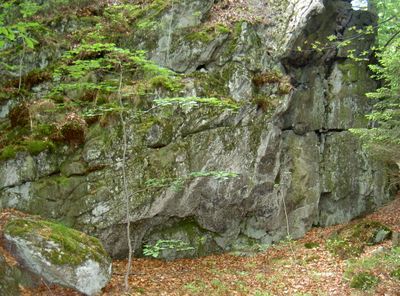
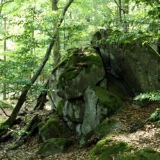
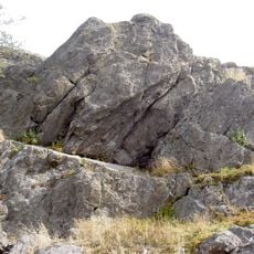
Weingartnerfels is a rocky formation that rises prominently from the forest floor in the Oberpfalz region near Schönsee. The structure displays clear layering and foliation patterns within its gneiss composition, reflecting the geological forces that shaped this area.
The rock formation originated millions of years ago through metamorphic processes that transformed granite into gneiss under intense pressure. This transformation is part of the broader geological history of how mountain-building forces shaped the Oberpfalz region.
The area surrounding Weingartnerfels serves as a meeting point for geological researchers who study the metamorphic rock formations and quartz inclusions.
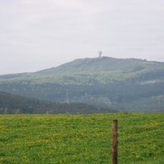
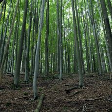
This rocky formation is reached via marked walking paths that connect to the regional trail network of the area. A visit works best in dry weather, as the paths can become slippery after rain.
The visible banding patterns within the gneiss display varying mineral densities that make the region's geological forces easy to observe firsthand. These visual differences allow visitors to understand how intense pressure and heat combined to reshape solid rock over immense spans of time.
Location: Schönsee
Elevation above the sea: 896 m
Length: 20 m
Width: 10 m
GPS coordinates: 49.52430,12.63200
Latest update: December 14, 2025 16:44
Plattenberg
2.9 km
Burgruine Reichenstein
1.3 km
Burgfels Reichenstein NE von Stadlern
1.4 km
Pleš
3 km
Malý Zvon
1.5 km
Veský mlýn
2.3 km
Nad Hutí
2.3 km
Böhmerwald Tower
48 m
Socha svatého Jana Nepomuckého u Pleše
3 km
Památník u Rybníka
3.2 km
Pomník u Švarcavy
3.2 km
Hochfels
2.2 km
Kříž u zaniklého Václava
1.6 km
Ehemaliges Wohnstallhaus
2.8 km
Boží muka před areálem bývalého kostela v Pleši
2.9 km
Ehemaliges Wohnstallhaus
1.4 km
Stadlern Reichenberg 3
2.6 km
Erdgeschossiges Halbwalmdachhaus
2.7 km
Wohnhaus
2.2 km
Ehemaliges Wohnstallhaus,
2.8 km
Kříž severně od Rybníka na místě zaniklé vsi
3.1 km
Ehemaliges Wohnstallhaus
2.8 km
Kříž severně od Rybníka u lesa
3.3 km
Kříž severně od Rybníka mezi stromy
3.2 km
Kříž u zaniklé Jánské Hutě
2.8 km
Kříž u zaniklé Švarcavy
3.4 km
Kaple Panny Marie na základech bývalého kostela v Pleši
2.9 km
Kříž nedaleko léčebny Medvědí kámen
2.5 kmVisited this place? Tap the stars to rate it and share your experience / photos with the community! Try now! You can cancel it anytime.
Discover hidden gems everywhere you go!
From secret cafés to breathtaking viewpoints, skip the crowded tourist spots and find places that match your style. Our app makes it easy with voice search, smart filtering, route optimization, and insider tips from travelers worldwide. Download now for the complete mobile experience.
A unique approach to discovering new places❞
— Le Figaro
All the places worth exploring❞
— France Info
A tailor-made excursion in just a few clicks❞
— 20 Minutes