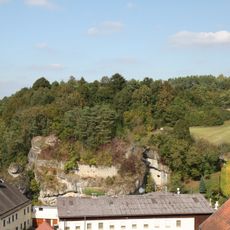
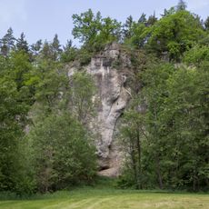
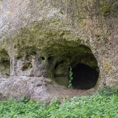
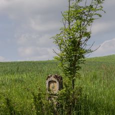
Höhle ohne Namen, Natural cave in Steinamwasser, Auerbach, Germany
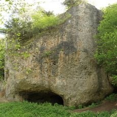
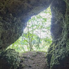
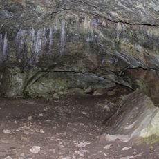
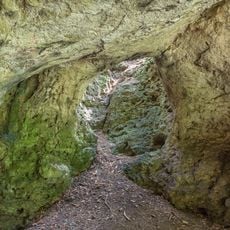
The Nameless Cave is a horizontal karst cave carved into limestone formations that extends approximately 530 meters into the rock. Its passages and chambers reach heights of up to 10 meters, creating a branching underground system beneath Auerbach.
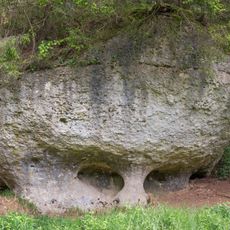
The cave was first documented in 1844 and later attracted attention when excavations took place in 1859. Those early investigations uncovered prehistoric remains, though their authenticity has been questioned ever since.
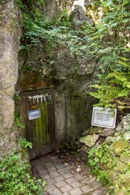
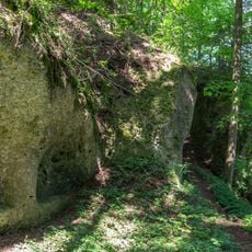
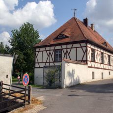
The cave entrance has long been tied to the nearby inn, where visitors and curious locals have gathered across generations. It remains woven into the town's identity and continues to shape how people relate to this corner of the landscape.
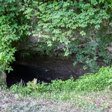
Access to the cave requires permission from the local innkeeper, and only the entrance area is easily accessible to visitors. Exploring deeper passages demands specialized caving gear, proper training, and experience in cave exploration.
Despite its significance as a protected landmark, this cave has never received an official name and remains nameless by tradition. It stands out among regional caves, most of which have been formally named and catalogued.
Location: Auerbach in der Oberpfalz
Elevation above the sea: 420 m
Length: 530 m
Width: 10 m
Accessibility: Wheelchair inaccessible
GPS coordinates: 49.72765,11.60377
Latest update: December 14, 2025 13:05
Michelfeld Abbey
2.9 km
Maria-Hilf-Kapelle
2.3 km
Burgruine Steinamwasser
160 m
Burgstall Gernotenstein
2.7 km
Marienkapelle
65 m
Kapelle Hl. Dreifaltigkeit
2.1 km
Marienkapelle
2.5 km
Höhle beim Felslindl
2.2 km
Friedhof
3 km
Felsen bei Steinamwasser
101 m
Guckerlochfelsen E von Michelfeld
2.7 km
Hanslhöhle
1.2 km
Bettelküche bei Staubershammer
2.4 km
Fachwerkbau mit Walmdach
3 km
Schmelcherfels SW von Steinamwasser
763 m
Höhle Felslindl ENE von Saaß (A54)
2.3 km
Felsen am Speckbach ENE von Saaß
2.3 km
Bauernhaus
2 km
Kruzifix und Sandsteinrelief
3.1 km
Brauerei-, Stallungs- und Pförtnergebäude
3 km
Guckerloch
2.7 km
Brückenfigur des heiligen Johann von Nepomuk
3 km
Bauernhaus
31 m
Torturm Michelfeld
3 km
Bildstock
3 km
Bildstock Saaß
2.5 km
Ehemaliger Hammerhof
2 km
Wegkapelle bei Steinamwasser
495 mVisited this place? Tap the stars to rate it and share your experience / photos with the community! Try now! You can cancel it anytime.
Discover hidden gems everywhere you go!
From secret cafés to breathtaking viewpoints, skip the crowded tourist spots and find places that match your style. Our app makes it easy with voice search, smart filtering, route optimization, and insider tips from travelers worldwide. Download now for the complete mobile experience.
A unique approach to discovering new places❞
— Le Figaro
All the places worth exploring❞
— France Info
A tailor-made excursion in just a few clicks❞
— 20 Minutes