Enable Location

We need your location to show you interesting places around you

Discover nearby places

Find interesting locations and hidden gems around you

Precise directions

Get accurate directions and distances to places

Your location is never shared with other users. It's only used when you tap the location button.

Geigerskopf

Log in to your account

Join the adventure

Create your free account and start exploring (like 60k+ others)

We will send you a code to connect

or
Continue with Google
Continue with Apple
By continuing, you accept our Terms and Conditions and our Privacy Policy

Check your inbox

We've sent a pincode in your inbox. Please enter the code below.

Geigerskopf

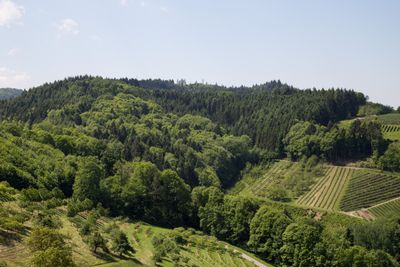
Geigerskopf, Mountain summit in Northern Black Forest, Germany

Description

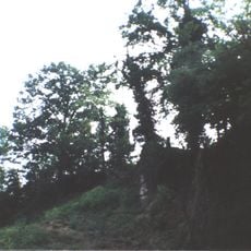
Geigerskopf is a forested mountain in the Northern Black Forest that rises to about 434 meters (1,425 ft). The slopes are covered with dense woodland and crossed by clearly marked hiking trails that lead upward from the surrounding area.

History

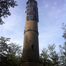
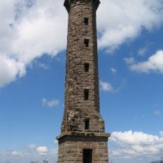
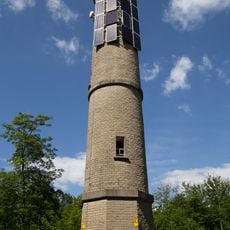
The mountain first gained a viewing platform in 1884, marking its emergence as a destination for visitors in the region. A steel observation tower was constructed in 1909, replacing earlier wooden structures and becoming a defining landmark of the site.

Culture

The mountain stands as part of the Black Forest region, where traditional activities include forestry, hiking clubs, and nature conservation efforts.

Practical

The mountain can be reached from Oberkirch via marked hiking trails, with parking facilities near the starting points. The paths are generally well-maintained and accessible to hikers of varying experience, so comfortable hiking boots and basic supplies are useful to bring along.

Did you know?

The steel observation tower at the summit is painted in rainbow colors and offers views reaching to the Vosges Mountains across the Rhine Valley on clear days. This colorful feature makes the structure visible from great distances and gives the site a memorable quality that sets it apart from comparable installations in the region.

Elevation above the sea
434.6 m
GPS coordinates
48.50579,8.05635
Latest update
December 14, 2025 20:31

AroundUs brings together thousands of curated places, local tips, and hidden gems, enriched daily by 60,000 contributors worldwide. Discover all places nearby (Germany).

« Geigerskopf - Mountain summit in Northern Black Forest, Germany » is provided by Around Us (aroundus.com). Images and texts are derived from Wikimedia project under a Creative Commons license. You are allowed to copy, distribute, and modify copies of this page, under the conditions set by the license, as long as this note is clearly visible.

Discover hidden gems everywhere you go!

From secret cafés to breathtaking viewpoints, skip the crowded tourist spots and find places that match your style. Our app makes it easy with voice search, smart filtering, route optimization, and insider tips from travelers worldwide. Download now for the complete mobile experience.

Around Us App Screenshot

A unique approach to discovering new places

Le Figaro

All the places worth exploring

France Info

A tailor-made excursion in just a few clicks

20 Minutes

Around Us
Travel Guide & Maps
Download

Send to your phone

QR Code
1

Open the camera app on your mobile.

2

Point at the QR code with your camera. A notification will appear.

3

Tap the notification to open the link.