River Spree/Berlin Glacial Valley Walk, Hiking trail network near River Spree, Berlin, Germany.
The River Spree Glacial Valley Walk is a hiking network along the Spree River through Berlin, linking parks and meadows together. The trail follows the river's curved form and reveals different landscape types from urban to natural areas along the way.
The valley formed during the last Ice Age when glacial movements carved deep channels in which the Spree now flows. These ice age processes shaped the landscape structure that hikers encounter along the route today.
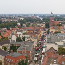
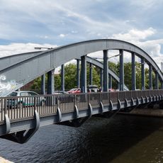
The trail passes through spaces where Berliners spend their weekends and the city maintains its connection to water. You can observe how people use the riverbanks and what role the river plays in the city's daily life.
Access to different sections is straightforward, as public transportation stops are located near entry points along the way. You can start or end your walk at various spots to suit your schedule and fitness level.
The path displays geological traces at several spots that prove ice once moved through here with great force. These visible signs help you understand how water and ice shaped the landscape over time.
Location: Berlin
Part of: 20 Green Walks in Berlin
Website: https://berlin.de/senuvk/umwelt/berlin_move/en/hauptwege/weg01.shtml
GPS coordinates: 52.53621,13.20869
Latest update: December 12, 2025 14:24
Altstadt Spandau
333 m
St. Marien am Behnitz
326 m
Saint Nicholas church
335 m
Charlotten Bridge
209 m
Juliusturmbrücke
258 m
Memorial to the Murdered Jews of Spandau
102 m
Fountain at Markt (Spandau)
338 m
Cineplex Spandau
300 m
Wohnhaus Breite Straße 10
313 m
Wohnhaus Breite Straße 9
320 m
Feldsteinbrunnen Spandau
232 m
Geschützgießerei Spandau
81 m
Wohn- und Geschäftshaus Breite Straße 33-34, Lindenufer 9-10
224 m
Wohnhaus Havelstraße 19
305 m
Warenhaus Woolworth
262 m
Wohnhaus & Seitenflügel & Quergebäude & Handwerkerhaus Fischerstraße 42
287 m
Spandauer Bank
349 m
Mietshaus Fischerstraße 40
270 m
Wohnhaus & Nebengebäude Fischerstraße 16 Lindenufer 16
153 m
Wohngebäude & Wohnhaus & Vorderhaus & Seitenflügel Charlottenstraße 9
322 m
Gotisches Haus
219 m
Wohnhaus & Nebengebäude & Handwerkerhaus & Mietshaus Fischerstraße 41
280 m
Dienstgebäude der Fortifikationsbehörde mit Nebengebäude Behnitz 3
315 m
Wohnhaus & Hofgebäude Charlottenstraße 10
329 m
Markt 5, Breite Straße 55
272 m
Wohnhaus Carl-Schurz-Straße 40
344 m
Wohnhaus, 2. Hälfte 18. Jh.; Seitenflügel und Quergebäude, zwischen Breite Straße 31
213 m
Ensemble Reformationsplatz mit Gasleuchten Reformationsplatz 2, 5-9, 11-12, Kirchgasse 3
327 mVisited this place? Tap the stars to rate it and share your experience / photos with the community! Try now! You can cancel it anytime.
Discover hidden gems everywhere you go!
From secret cafés to breathtaking viewpoints, skip the crowded tourist spots and find places that match your style. Our app makes it easy with voice search, smart filtering, route optimization, and insider tips from travelers worldwide. Download now for the complete mobile experience.
A unique approach to discovering new places❞
— Le Figaro
All the places worth exploring❞
— France Info
A tailor-made excursion in just a few clicks❞
— 20 Minutes