Enable Location

We need your location to show you interesting places around you

Discover nearby places

Find interesting locations and hidden gems around you

Precise directions

Get accurate directions and distances to places

Your location is never shared with other users. It's only used when you tap the location button.

Upper German-Raetian Limes

Log in to your account

Start exploring — it's free

Trusted by 61,334 travelers worldwide

Continue with Google
Continue with Apple
or

We will send you a code to connect

By continuing, you accept our Terms and Conditions and our Privacy Policy

Check your inbox

We've sent a pincode in your inbox. Please enter the code below.

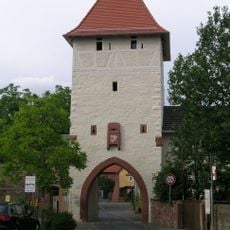
Upper German-Raetian Limes, Roman frontier archaeological site in Bavaria, Germany

Description

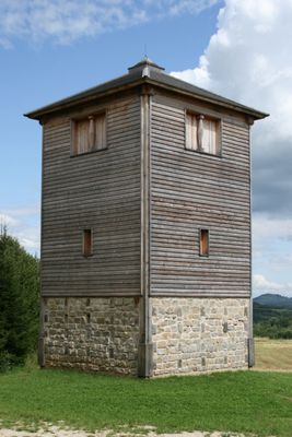
The Upper German-Raetian Limes is a Roman frontier fortification that stretches 550 kilometers (340 miles) from the Rhine to the Danube across present-day Bavaria and neighboring federal states. The structure consists of earthworks, stone walls, ditches, and the foundations of numerous watchtowers that remain visible in the landscape at many locations.

History

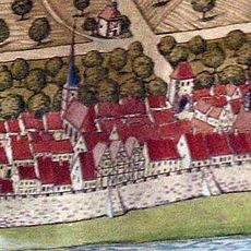
The fortification began as a wooden palisade in the 1st century AD and was later partially replaced by stone walls. In the year 260, the Romans abandoned the frontier line when Germanic tribes overran the territory and soldiers withdrew behind the Rhine and Danube.

Culture

The name comes from the Roman provinces of Germania Superior and Raetia, which met along this boundary. Today visitors see reconstructed wooden towers and palisades that show how Roman soldiers guarded the line and controlled the movement of goods.

Practical

The remains are spread across wide countryside with fields, forests, and small towns, so visitors often drive or cycle between individual locations. On site, marked hiking trails lead to visible sections and information panels explain the function of each installation.

Did you know?

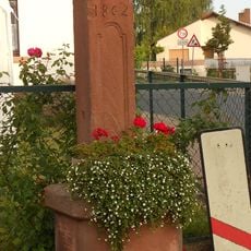
At some locations the remains of the frontier are hidden beneath modern roads and fields, while other sections run as low embankments through residential areas. The total length makes it the longest surviving Roman land frontier in Europe.

Location
Location
Raetia
Location
Germania Superior
Part of
Limes Germanicus
Shares border with
Germania Superior, Raetia
GPS coordinates
49.79639,9.15750
Latest update
December 13, 2025 18:48

AroundUs brings together thousands of curated places, local tips, and hidden gems, enriched daily by 60,000 contributors worldwide. Discover all places nearby (Bavaria).

« Upper German-Raetian Limes - Roman frontier archaeological site in Bavaria, Germany » is provided by Around Us (aroundus.com). Images and texts are derived from Wikimedia project under a Creative Commons license. You are allowed to copy, distribute, and modify copies of this page, under the conditions set by the license, as long as this note is clearly visible.

Discover hidden gems everywhere you go!

From secret cafés to breathtaking viewpoints, skip the crowded tourist spots and find places that match your style. Our app makes it easy with voice search, smart filtering, route optimization, and insider tips from travelers worldwide. Download now for the complete mobile experience.

Around Us App Screenshot

A unique approach to discovering new places

Le Figaro

All the places worth exploring

France Info

A tailor-made excursion in just a few clicks

20 Minutes

Around Us
Travel Guide & Maps
Download

Send to your phone

QR Code
1

Open the camera app on your mobile.

2

Point at the QR code with your camera. A notification will appear.

3

Tap the notification to open the link.