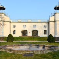
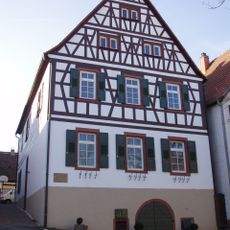
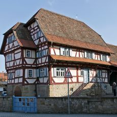
Schloss Unteröwisheim, Medieval château in Kraichtal, Germany
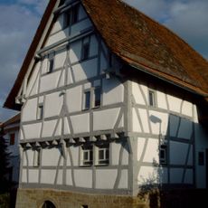
Schloss Unteröwisheim is a medieval administrative building in the Baden-Württemberg municipality of Kraichtal with characteristic stone walls and solid construction. The building displays the typical architecture of Pfleghofs, which functioned as regional administrative seats for larger institutions.
The building emerged in the medieval period as an administrative seat for Maulbronn Monastery and served to oversee lands and collect local taxes across the region. Its role as a Pfleghof made it an important link between monastic authority and the rural population.
The castle was closely tied to Maulbronn Monastery's administration and shows how religious institutions controlled the rural region. Visitors can see today how such buildings served as administrative centers and managed local affairs.
The castle is located in Kraichtal and can be easily reached via the main road through the town, with parking available nearby. Visiting allows you to view the building from outside and study the medieval construction style, which is informative regarding regional history.
The building preserves its original stone foundations to this day and reveals little-known details about how monastic estates were practically organized in medieval times. This construction method offers insights into the technical skills of the era, often overshadowed by larger cathedral projects.
The community of curious travelers
AroundUs brings together thousands of curated places, local tips, and hidden gems, enriched daily by 60,000 contributors worldwide.