Rangierbahnhof, Statistical district in Nuremberg, Germany
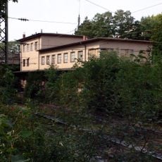
Rangierbahnhof is the name of statistical district 41 in the southeast of Nuremberg, part of statistical city district 4 (Südliche Außenstadt), about 5 kilometres from the city centre. Its southern part holds the tracks of the Nuremberg marshalling yard, while the larger northern area around Brunecker Straße has long lain largely derelict; the former freight station site was used as a scrapyard and is now mostly cleared.
Rangierbahnhof is the name of statistical district 41 in the southeast of Nuremberg, part of statistical city district 4 (Südliche Außenstadt). Its southern part holds the yards of the Nuremberg marshalling station, while the larger northern area around Brunecker Straße lay largely fallow for years. The former freight station (Nürnberg Südbahnhof) was used as a scrapyard after closure and has since been largely cleared.
The district takes its name from the freight yard in its southern part, while the larger northern area around Brunecker Straße lay fallow for years. The former Nürnberg Südbahnhof goods station was used as a scrapyard after closure and has since been largely cleared. The planned Lichtenreuth quarter is to be built here in four stages.
The district lies about 5 kilometres southeast of Nuremberg's centre and is reached via Brunecker Straße. The northern area around that street has long been largely derelict and is now mostly cleared, while the southern part holds the rail yard itself. Expect construction as the Lichtenreuth development proceeds in four phases.
The district's name comes from the freight yard in its southern part, but most of its area around Brunecker Straße has long been unused land. The former Nürnberg Südbahnhof goods station there was used as a scrapyard after closure and has since been largely cleared.
The community of curious travelers
AroundUs brings together thousands of curated places, local tips, and hidden gems, enriched daily by 92,639 contributors worldwide.