Altenberg Pinge, Mining heritage monument in Altenberg, Germany
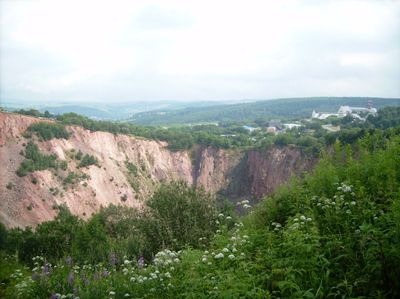
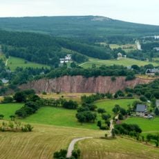
Altenberg Pinge is a deep circular depression in the ground formed by the collapse of underground mining tunnels. The bowl measures roughly 400 meters across and 150 meters deep, creating a striking geographical feature in the landscape.
The depression formed on January 24, 1620, when underground mining chambers collapsed beneath the surface. Centuries of tin extraction had weakened the rock below until it could no longer support itself.
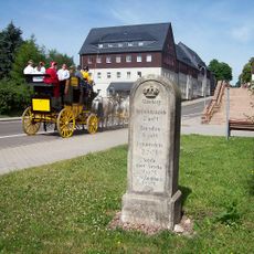
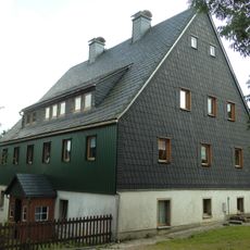
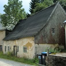
The site shows how mining shaped the identity of the local region for generations. You can sense how the community's entire way of life once revolved around extracting ore from below.
The site is open to visitors year-round and best viewed from the rim where you get the full sense of the scale. Guided tours available through the local tourism office provide helpful context about the mining history.
The hole is so vast that standing at the rim leaves you struggling to grasp its actual size from photographs. It remains one of the most dramatic reminders of how mining literally reshaped the earth.
Location: Altenberg
Inception: January 24, 1620
Length: 150 m
Diameter: 400 m
Industry: Mining of other non-ferrous metal ores, mining
GPS coordinates: 50.76583,13.76389
Latest update: December 8, 2025 19:40
Altenberger Binge („Bergbaumonumente Altenberg“)
8 m
Royal Saxon milestone Dresdner Straße Altenberg
330 m
Wohnhaus Zinnwalder Straße 2
363 m
Wohnhaus Bachstraße 15
473 m
Überhaun 32 („Bergbaumonumente Altenberg“) Bergarbeitersiedlung
350 m
Wohnhaus Bachstraße 11
440 m
Wohnhaus Zinnwalder Straße 10
364 m
Gedenkstein Neustadtstraße
456 m
Wohnstallhaus Römerstraße 2
303 m
Wohnhaus Bachstraße 5
430 m
Wohnhaus Zinnwalder Straße 8
365 m
Gedenkstein Mühlenstraße 2
432 m
Wohnhaus Zinnwalder Straße 4
359 m
Überhaun 20 („Bergbaumonumente Altenberg“) Bergarbeitersiedlung
389 m
Wohnhaus Uferweg 1
384 m
Wohnhaus Uferweg 2
389 m
Wohnhaus Bergstraße 3
366 m
Vereinigt Feld im Zwitterstock zu Altenberg („Bergbaumonumente Altenberg“) Bergarbeitersiedlung
367 m
Vereinigt Feld im Zwitterstock zu Altenberg – Römerschacht („Bergbaumonumente Altenberg“) Römerstraße
262 m
Wohnhaus Römerstraße 6
297 m
Wohnhaus Bachstraße 7
445 m
Rathaus Platz des Bergmanns 2
331 m
Wohnhaus Rathausstraße 5
306 m
Postamt Rathausstraße 10
321 m
Bergmannsbrunnen („Bergbaumonumente Altenberg“) Obere Straße
282 m
Portal Bachstraße 3
401 m
Transformatorenhäuschen Römerstraße 2
305 m
Wohnstallhaus Zinnwalder Straße 6
362 mVisited this place? Tap the stars to rate it and share your experience / photos with the community! Try now! You can cancel it anytime.
Discover hidden gems everywhere you go!
From secret cafés to breathtaking viewpoints, skip the crowded tourist spots and find places that match your style. Our app makes it easy with voice search, smart filtering, route optimization, and insider tips from travelers worldwide. Download now for the complete mobile experience.
A unique approach to discovering new places❞
— Le Figaro
All the places worth exploring❞
— France Info
A tailor-made excursion in just a few clicks❞
— 20 Minutes