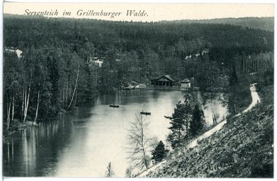
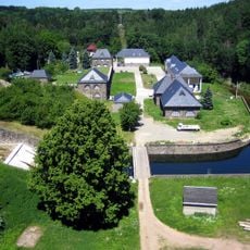
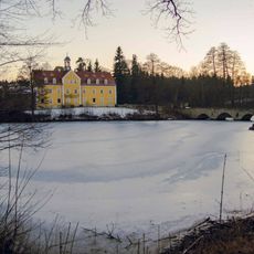
Seerenteich, Historical reservoir in Tharandt Forest, Germany
Seerenteich is a reservoir in Tharandt Forest built with a distinctive weight-based dam that holds water in the Seerenbach valley. The water body creates a clear opening surrounded by dense forest on all sides.
The reservoir was created in 1828 on the site of a former pond and initially served to transport logs down the valley by raft. Railway construction in the area around 1860 ended the need for this water transport method.
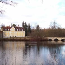
The reservoir became a leisure destination in the 1800s where locals enjoyed boating and walking along its shores. Today it continues to serve as a gathering place where visitors experience the quiet of the forest setting.
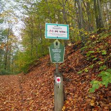
The site is accessible by forest paths and works well for walking or hiking routes through the woods. The shoreline can be reached, though plants along the water may be thick depending on the season.
The dam uses a fascinating construction method where heavy stones alone hold back the water through their weight. This engineering approach is less common today and shows a historical technique rarely seen in modern structures.
Location: Tharandt
Inception: 1828
Address: Grillenburg
GPS coordinates: 50.94443,13.53844
Latest update: December 9, 2025 20:24
Grillenburg Hunting Lodge
2.4 km
Klingenberg-Colmnitz station
3.3 km
Streichholzbrücke
3.6 km
Wassermühle Tharandt-Grillenburg
2.5 km
Weißeritztalhänge
3.5 km
Wasserwerk Klingenberg
4 km
Friedhof
2.1 km
Hosenmühle
2.3 km
Barthmühle
2.9 km
Vordermühle Klingenberg
3 km
Schule in historistischen Formen Dorfstraße 9b
3.5 km
Joseph-Bondi-Haus
2.7 km
Protestant Church
3 km
Empfangsgebäude des Haltepunkts Edle Krone; Eisenbahnstrecke Dresden–Werdau
3.2 km
Oberer St.-Michaelis-Stolln und Thelersäule Höckendorf
3.6 km
Stübemühle
3.2 km
Rest einer »Thelersäule« Kirchweg -
3.9 km
Rittergut Klingenberg
3.2 km
Station 78 Klingenberg
3.8 km
Eisenbahnbrücke über den Seerenbach bei Dorfhain
2.4 km
Winkelmühle Dorfhain
2.8 km
Hintermühle Klingenberg
3.5 km
Wohnmühlenhaus
2.3 km
Sachgesamtheit '''Jagdschloss Grillenburg''' mit den Einzeldenkmalen: Schloss, Neues Jägerhaus, Jagdhütte und drei weitere Gebäude Hauptstraße 7
2.4 km
Jagdschloss Grillenburg mit Schloss, Einfriedung, Neues Jägerhaus, Jagdhütte und drei weitere Gebäude (Einzeldenkmale zu ID-Nr. 09300820) Hauptstraße 7
2.4 km
Grillenburger Mühle; Wiesenhaus Hauptstraße 18
2.4 km
Kriegerdenkmal für die Gefallenen des I. Weltkrieges, kreisförmiger Platz mit Einfriedung, Treppenanlage und Torbogen sowie Bäume außerhalb des Platzes Tharandter Straße 6 (gegenüber)
4 km
Bildstock Dorfstraße -
3.5 kmVisited this place? Tap the stars to rate it and share your experience / photos with the community! Try now! You can cancel it anytime.
Discover hidden gems everywhere you go!
From secret cafés to breathtaking viewpoints, skip the crowded tourist spots and find places that match your style. Our app makes it easy with voice search, smart filtering, route optimization, and insider tips from travelers worldwide. Download now for the complete mobile experience.
A unique approach to discovering new places❞
— Le Figaro
All the places worth exploring❞
— France Info
A tailor-made excursion in just a few clicks❞
— 20 Minutes