Chest opened
+${chestReward.xp} XP
Explorer
NOUVEAU ×${chestReward.collectible.quantity}
tapez pour fermer
Chest locked

Open chests in the app

Around Us is built for your phone — chests unlock when you walk, explore and capture nearby places.

Enable Location

We need your location to show you interesting places around you

Discover nearby places

Find interesting locations and hidden gems around you

Precise directions

Get accurate directions and distances to places

Your location is never shared with other users. It's only used when you tap the location button.

Log in to your account

Start exploring — it's free

Trusted by 72,887 travelers worldwide

Continue with Google
Continue with Apple
or

We will send you a code to connect

By continuing, you accept our Terms and Conditions and our Privacy Policy

Check your inbox

We've sent a pincode in your inbox. Please enter the code below.

Manistee River Trail
Discussion Reviews Photo
2.3k Popularity

Manistee River Trail, Forest hiking trail along Manistee River in Michigan, United States.

The Manistee River Trail is a forest pathway in Michigan that follows the river through wooded terrain with changing elevations and varied landscapes. The route winds through dense trees and crosses multiple streams, offering different views of the natural surroundings at each bend.

The trail was established in 1992 within the National Forest to provide public access to the area's natural spaces. Its creation reflected efforts to develop recreational paths across Michigan's forested regions.

Local Native American tribes maintained strong connections to the Manistee River area, using its resources for generations before the trail's development.

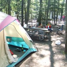
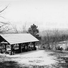
Several access points with parking areas, basic facilities, and water sources allow visitors to start from different spots. Campsites scattered along the route make it possible to hike over multiple days and spend nights outdoors.

A striking wooden suspension bridge with steel cables crosses the river and is one of the largest of its kind in the region. Many hikers consider this structure one of the most memorable features of their visit.

The community of curious travelers

AroundUs brings together thousands of curated places, local tips, and hidden gems, enriched daily by 60,000 contributors worldwide.

Start exploring
Location
GPS coordinates
44.36211,-85.82206
Latest update
December 13, 2025 12:25
Around this place
Interlochen State Park
United States of America

Interlochen State Park

29.9 km
Mitchell State Park
United States of America

Mitchell State Park

32.5 km
John J. Makinen Bottle House
United States of America

John J. Makinen Bottle House

15 km
Cadillac-Soo Lumber Company 3
United States of America

Cadillac-Soo Lumber Company 3

36.2 km
Udell Lookout Tower
United States of America

Udell Lookout Tower

28 km
Charles T. Mitchell House
United States of America

Charles T. Mitchell House

35.9 km
Cadillac Public Library
United States of America

Cadillac Public Library

35.9 km
Chapel of St. John-by-the-Lake
United States of America

Chapel of St. John-by-the-Lake

30.8 km
Elks Temple Building
United States of America

Elks Temple Building

35.9 km
Cobbs and Mitchell Building
United States of America

Cobbs and Mitchell Building

36.1 km
Masonic Temple Building
United States of America

Masonic Temple Building

35.8 km
Camp Tosebo
United States of America

Camp Tosebo

33.5 km
Sandenburgh-Rogers Summer Resort Complex
United States of America

Sandenburgh-Rogers Summer Resort Complex

35 km
Kresge Auditorium
United States of America

Kresge Auditorium

30 km
Bottle House Museum
United States of America

Bottle House Museum

14.9 km
Pacific Salmon Historical Marker
United States of America

Pacific Salmon Historical Marker

34.7 km
Interlochen Historical Marker
United States of America

Interlochen Historical Marker

30.2 km
Mills Community House Historical Marker
United States of America

Mills Community House Historical Marker

36.1 km
Mesick Public Library
United States of America

Mesick Public Library

9.8 km
Cadillac Wexford Public Library
United States of America

Cadillac Wexford Public Library

36 km
Betsie Valley District Library
United States of America

Betsie Valley District Library

20 km
Kingsley Village Office
United States of America

Kingsley Village Office

33.5 km
Onekama Branch Library
United States of America

Onekama Branch Library

29.8 km
Udell Rollways Day Use Area
United States of America

Udell Rollways Day Use Area

23.6 km
Benzonia Public Library
United States of America

Benzonia Public Library

36 km
Joyfield Cemetery Historical Marker
United States of America

Joyfield Cemetery Historical Marker

30.9 km
Kingsley Middle School
United States of America

Kingsley Middle School

33.3 km
Brownson Memorial Park
United States of America

Brownson Memorial Park

33.5 km
Show the full map
Reviews
Share your experience

No review yet

Discussions
Start a discussion...

No discussion yet

« Manistee River Trail - Forest hiking trail along Manistee River in Michigan, United States » is provided by Around Us (aroundus.com). Images and texts are derived from Wikimedia project under a Creative Commons license. You are allowed to copy, distribute, and modify copies of this page, under the conditions set by the license, as long as this note is clearly visible.

Discover hidden gems everywhere you go!

From secret cafés to breathtaking viewpoints, skip the crowded tourist spots and find places that match your style. Our app makes it easy with voice search, smart filtering, route optimization, and insider tips from travelers worldwide. Download now for the complete mobile experience.

Around Us App Screenshot

A unique approach to discovering new places

Le Figaro

All the places worth exploring

France Info

A tailor-made excursion in just a few clicks

20 Minutes

Around Us
Travel Guide & Maps
Download

Send to your phone

QR Code
1

Open the camera app on your mobile.

2

Point at the QR code with your camera. A notification will appear.

3

Tap the notification to open the link.