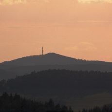
Simonsberg, heuvel in Rijnland-Palts, Duitsland
Location: Rhineland-Palatinate
GPS coordinates: 50.25673,6.92100
Latest update: November 7, 2025 17:16
Hochkelberg
3 km
St. Vinzenz
3.5 km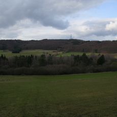
Hochkelberg mit Mosbrucher Weiher
2.5 km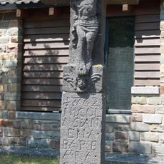
Wegekreuz
3.5 km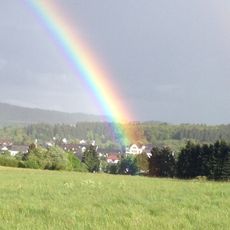
Kelberg
3.6 km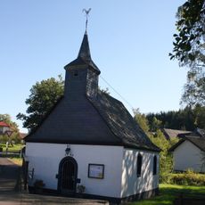
Kirche
1.8 km
Ringelbachberg
638 m
Wayside cross
3.5 km
Catholic church building, wayside shrine, Christianity
3.7 km
Scenic viewpoint
2 km
Afelskreuz
1.1 km
Catholic church building, wayside cross, Christianity
3.4 km
Wayside cross
3.2 km
Wayside shrine
3.3 km
Teufelsstein
515 m
Wayside cross
3.7 km
Wayside cross
3.4 km
Wayside cross, Christianity, Catholic church building
3 km
Baumelbank Köttelbach
2.1 km
Catholic church building, wayside shrine, Christianity
3.7 km
Catholic church building, wayside shrine, Christianity
3.7 km
Catholic church building, wayside shrine, Christianity
3.7 km
War memorial, memorial
3.7 km
Catholic church building, wayside shrine, Christianity
3.7 km
Catholic church building, wayside shrine, Christianity
3.7 km
Catholic church building, wayside shrine, Christianity
3.7 km
Catholic church building, wayside shrine, Christianity
3.6 km
Water well
3.4 kmReviews
Visited this place? Tap the stars to rate it and share your experience / photos with the community! Try now! You can cancel it anytime.
Discover hidden gems everywhere you go!
From secret cafés to breathtaking viewpoints, skip the crowded tourist spots and find places that match your style. Our app makes it easy with voice search, smart filtering, route optimization, and insider tips from travelers worldwide. Download now for the complete mobile experience.

A unique approach to discovering new places❞
— Le Figaro
All the places worth exploring❞
— France Info
A tailor-made excursion in just a few clicks❞
— 20 Minutes