Chest opened
+${chestReward.xp} XP
Explorer
NOUVEAU ×${chestReward.collectible.quantity}
tapez pour fermer
Chest locked

Open chests in the app

Around Us is built for your phone — chests unlock when you walk, explore and capture nearby places.

Enable Location

We need your location to show you interesting places around you

Discover nearby places

Find interesting locations and hidden gems around you

Precise directions

Get accurate directions and distances to places

Your location is never shared with other users. It's only used when you tap the location button.

Log in to your account

Start exploring — it's free

Trusted by 73,083 travelers worldwide

Continue with Google
Continue with Apple
or

We will send you a code to connect

By continuing, you accept our Terms and Conditions and our Privacy Policy

Check your inbox

We've sent a pincode in your inbox. Please enter the code below.

Klütjenfelder Hauptdeich
Discussion Reviews Photo
1.2k Popularity

Klütjenfelder Hauptdeich, Flood protection levee in Wilhelmsburg, Hamburg, Germany

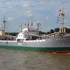
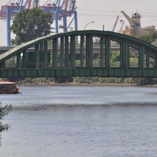
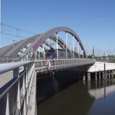
Klütjenfelder Hauptdeich is a flood protection levee running about 2.5 kilometers between Spreehafen harbor and Wilhelmsburg district. The walkway includes views of industrial cranes, historical signage about the port, and a notably long public bench for sitting.

The levee failed during the catastrophic 1962 flood, causing severe flooding across Wilhelmsburg with hundreds of casualties. This disaster underscored the critical importance of flood defenses for the city's survival.

The levee represents a shift from a closed industrial zone to public space where people can move freely along the water. You can sense how the place tells a story about access and inclusion in the city's waterfront.

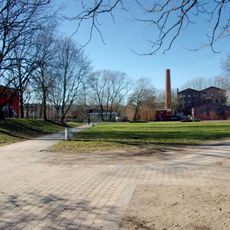
The levee is freely accessible with a flat, easy-to-walk path suitable for most visitors. Weather affects visibility of the harbor, so clear days offer the best views of the waterfront.

For over 120 years, a customs fence blocked public access to the levee until two gates opened in 2010. This reopening allowed Hamburg residents to walk along their waterfront for the first time in generations.

The community of curious travelers

AroundUs brings together thousands of curated places, local tips, and hidden gems, enriched daily by 60,000 contributors worldwide.

Start exploring
Location
GPS coordinates
53.51978,9.99458
Latest update
December 14, 2025 18:42
Reviews
Share your experience

No review yet

Discussions
Start a discussion...

No discussion yet

« Klütjenfelder Hauptdeich - Flood protection levee in Wilhelmsburg, Hamburg, Germany » is provided by Around Us (aroundus.com). Images and texts are derived from Wikimedia project under a Creative Commons license. You are allowed to copy, distribute, and modify copies of this page, under the conditions set by the license, as long as this note is clearly visible.

Discover hidden gems everywhere you go!

From secret cafés to breathtaking viewpoints, skip the crowded tourist spots and find places that match your style. Our app makes it easy with voice search, smart filtering, route optimization, and insider tips from travelers worldwide. Download now for the complete mobile experience.

Around Us App Screenshot

A unique approach to discovering new places

Le Figaro

All the places worth exploring

France Info

A tailor-made excursion in just a few clicks

20 Minutes

Around Us
Travel Guide & Maps
Download

Send to your phone

QR Code
1

Open the camera app on your mobile.

2

Point at the QR code with your camera. A notification will appear.

3

Tap the notification to open the link.