
, brechelhütte, erdgeschossiger Bruchsteinbau, wohl Mitte 19. Jahrhundert; am östlichen Ortsausgang
Location: Traunstein
Address: Tinnerting
GPS coordinates: 47.85133,12.60686
Latest update: August 17, 2025 02:08

Michael Traunstein
2.4 km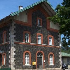
Bergen (Oberbayern) station
3 km
Mariä Verkündigung (Haslach)
1.9 km
Kapelle
3.3 km
Äußere Rosenheimer Straße 21 (Traunstein)
2.7 km
Auferstehungskirche (Traunstein)
3.1 km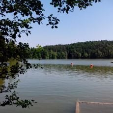
LSG Tüttensee
2.8 km
Crailsheimstraße 17
3 km
Herzog-Friedrich-Straße 10a
3.1 km
Bachmayerstraße 1
2.9 km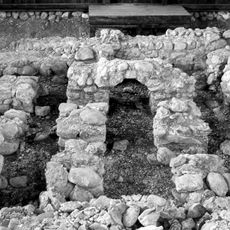
Villa rustica der römischen Kaiserzeit
3.3 km
Konglomerate des Aquitan an der Blauen Wand S von Traunstein
2.8 km
Leonrodstraße 4a
3 km
Villenartiges Wohnhaus
3.1 km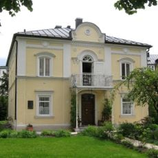
Villa Hager
3.3 km
Rosenheimer Straße 5 Traunstein
3.1 km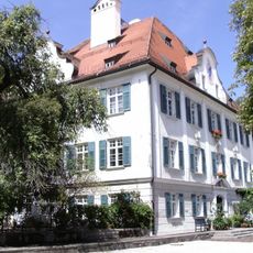
Ehem. Pfarrhof
1.8 km
Bahnhofstraße 32
3.2 km
Ehemalige Augenklinik Dr. Ferdinand Fischer
3 km
Doppelwohnhaus
3 km
Wochinger-Keller
3.1 km
Haslacher Straße 18
3 km
Crailsheimstraße 1
3.3 km
Sommerkeller
2.9 km
Bahnhofsempfangsgebäude
3.1 km
Herzog-Friedrich-Straße 8 Traunstein
3.2 km
Bahnhofstraße 28
3.2 km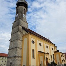
Mariä Himmelfahrt
1 kmReviews
Visited this place? Tap the stars to rate it and share your experience / photos with the community! Try now! You can cancel it anytime.
Discover hidden gems everywhere you go!
From secret cafés to breathtaking viewpoints, skip the crowded tourist spots and find places that match your style. Our app makes it easy with voice search, smart filtering, route optimization, and insider tips from travelers worldwide. Download now for the complete mobile experience.

A unique approach to discovering new places❞
— Le Figaro
All the places worth exploring❞
— France Info
A tailor-made excursion in just a few clicks❞
— 20 Minutes