
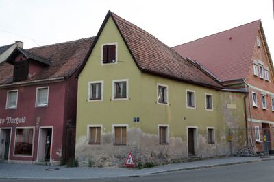
Neunstetterstraße 1, schmaler zweigeschossiger Satteldachbau, in Ecklage, Fachwerk verputzt, im Kern 16./17. Jahrhundert, rückwärtig an Stadtmauer grenzend, siehe Stadtbefestigung
Location: Herrieden
Address: Neunstetterstraße 1, beim ehemaligen Ansbacher Tor
GPS coordinates: 49.23442,10.49548
Latest update: March 4, 2025 20:02
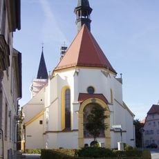
St. Vitus und Deocar Herrieden
280 m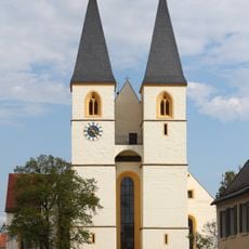
Herrnhof 20, 21, 22
275 m
Fronveststraße 12 (Herrieden)
186 m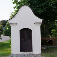
Dreifaltigkeitskapelle
216 m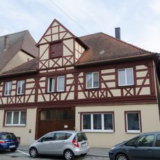
Vordere Gasse 1
188 m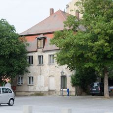
Marktplatz 18
245 m
Marktplatz 13 (Herrieden)
204 m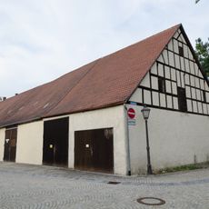
Vogteiplatz 7
263 m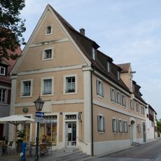
Ehemaliges Rathaus, auch Brothaus
270 m
Marktplatz 8
224 m
Neunstetterstraße 15, 17
131 m
Marktplatz 10
204 m
Marktplatz 11, 12 (Herrieden)
185 m
Marktplatz 4
262 m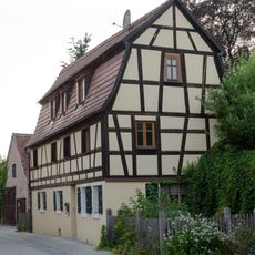
Wohnhaus
79 m
Neunstetterstraße 11, 13
109 m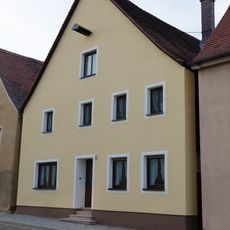
Neunstetterstraße 12
54 m
Neunstetterstraße 14
63 m
Wohngebäude, sogenanntes Jungfernhäusl
204 m
Turmstraße 1
239 m
Marktplatz 2 (Herrieden)
252 m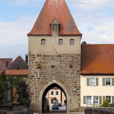
Storchenturm
269 m
Vordere Gasse 13
106 m
Giebelhaus mit Volutengiebel
14 m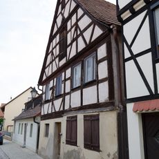
Wohngebäude
98 m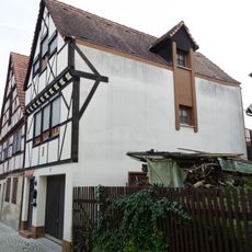
Wohngebäude
103 m
Fronveststraße 2
187 m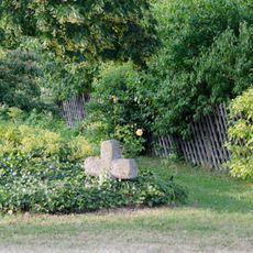
Steinkreuz in Herrieden
210 mReviews
Visited this place? Tap the stars to rate it and share your experience / photos with the community! Try now! You can cancel it anytime.
Discover hidden gems everywhere you go!
From secret cafés to breathtaking viewpoints, skip the crowded tourist spots and find places that match your style. Our app makes it easy with voice search, smart filtering, route optimization, and insider tips from travelers worldwide. Download now for the complete mobile experience.

A unique approach to discovering new places❞
— Le Figaro
All the places worth exploring❞
— France Info
A tailor-made excursion in just a few clicks❞
— 20 Minutes