Stadtkirche Zum Heiligen Namen Gottes Radeberg
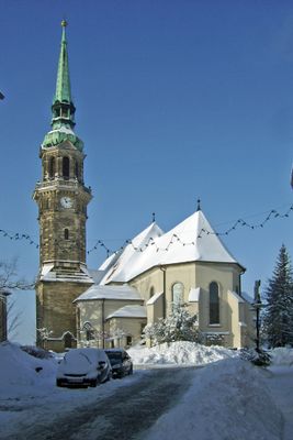
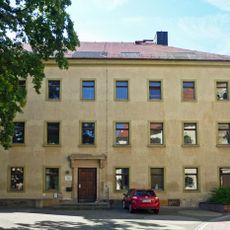
Stadtkirche Zum Heiligen Namen Gottes Radeberg, Lutheran church in Radeberg, Germany
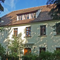
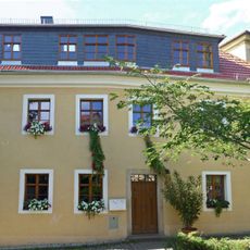
The Stadtkirche Zum Heiligen Namen Gottes is a church building in Radeberg with sandstone walls and large windows, situated on a hilltop near the city center. The structure's imposing architecture shapes the town's appearance and remains visible from multiple angles around the area.
The current building was constructed starting in 1730 following a church fire in 1714 that destroyed the earlier structure. The new construction was realized under Superintendent Valentin Ernst Löscher and has defined the town since.
The church serves as a gathering place where people mark important occasions and milestones in their lives. Regular services and celebrations bring the community together around shared beliefs and traditions.
Visitors can find the church at An der Kirche 5 and may attend regular services or view the interior during open hours. It helps to check opening times in advance, as the building is not always freely accessible.
The baptismal font from 1730 displays intricately carved biblical scenes in sandstone that represent Saxon baroque craftsmanship of the era. This ornate work is frequently overlooked, though it stands as one of the first artworks visitors encounter inside.
Location: Radeberg
Inception: 1730
Address: An der Kirche 5, 01454 Radeberg
GPS coordinates: 51.11783,13.92025
Latest update: December 9, 2025 20:20
Kriegerdenkmal Radeberg
83 m
Grundschule Schulstraße 1
100 m
Wohnhaus mit Laden in geschlossener Bebauung Hauptstraße 8
112 m
Kirchgemeindehaus mit Saal Pulsnitzer Straße 8
81 m
Wohnhaus in Ecklage mit Hofflügel Hauptstraße 23
112 m
Ehemalige Kommandantur der Radeberger Garnison und Hinterhaus Hauptstraße 10
100 m
Wohnhaus in geschlossener Bebauung Obergraben 6
63 m
Wohnhaus in geschlossener Bebauung mit Hinterflügel Hauptstraße 13
107 m
Wohnhaus in offener Bebauung An der Kirche 6
47 m
Wohnhaus in geschlossener Bebauung Obergraben 4
74 m
Wohnhaus mit Laden in geschlossener Bebauung Obergraben 3
83 m
Pfarrhaus mit Nebengebäude An der Kirche 7
44 m
Diakonat; Wohnhaus in offener Bebauung An der Kirche 2
44 m
Wohnhaus Obergraben 14
45 m
Mietshaus mit Ladenzone in Ecklage mit Anbau zur Berggasse und Werbeausleger mit Uhr Hauptstraße 21
110 m
Wohnhaus in geschlossener Bebauung Niedergraben 12
105 m
Wohnhaus in geschlossener Bebauung Obergraben 5
69 m
Wohnhaus Obergraben 10
57 m
Wohnhaus in geschlossener Bebauung Niedergraben 11
113 m
Wohnhaus in geschlossener Bebauung Niedergraben 16
67 m
Wohnhaus mit Laden in halboffener Bebauung Hauptstraße 20
92 m
Mauer entlang des Obergrabens ab Haus Nummer 12 bis zur Zufahrt zum Kirchplatz Obergraben 12 (ab Nr. 12 bis Zufahrt Kirchplatz)
61 m
Wohnhaus in geschlossener Bebauung Hauptstraße 18
85 m
Wohnhaus Obergraben 16
46 m
Wohnhaus in geschlossener Bebauung Hauptstraße 16
84 m
Wohnhaus in geschlossener Bebauung mit Hinterflügel Hauptstraße 15
105 m
Pelzhaus zum Stern (ehemals); Wohnhaus in Ecklage Hauptstraße 12
91 m
Stadtschule An der Kirche 3
31 mVisited this place? Tap the stars to rate it and share your experience / photos with the community! Try now! You can cancel it anytime.
Discover hidden gems everywhere you go!
From secret cafés to breathtaking viewpoints, skip the crowded tourist spots and find places that match your style. Our app makes it easy with voice search, smart filtering, route optimization, and insider tips from travelers worldwide. Download now for the complete mobile experience.
A unique approach to discovering new places❞
— Le Figaro
All the places worth exploring❞
— France Info
A tailor-made excursion in just a few clicks❞
— 20 Minutes