Enable Location

We need your location to show you interesting places around you

Discover nearby places

Find interesting locations and hidden gems around you

Precise directions

Get accurate directions and distances to places

Your location is never shared with other users. It's only used when you tap the location button.

Lechstaustufe 19 – Schwabstadl

Log in to your account

Start exploring — it's free

Trusted by 63,016 travelers worldwide

Continue with Google
Continue with Apple
or

We will send you a code to connect

By continuing, you accept our Terms and Conditions and our Privacy Policy

Check your inbox

We've sent a pincode in your inbox. Please enter the code below.

Lechstaustufe 19 – Schwabstadl
Discussion Reviews 1 Photos
1.1k Popularity

Lechstaustufe 19 – Schwabstadl

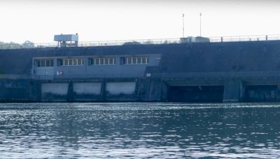
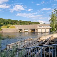
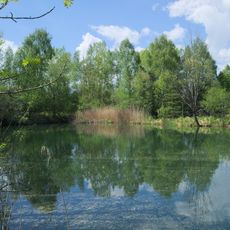
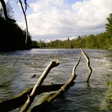
Lechstaustufe 19, also known as Schwabstadl, is a dam on the Lech River near Scheuring with three Kaplan turbines that can produce up to 12 megawatts of power. Behind the dam lies a reservoir extending about 5 kilometers, covering roughly 90 hectares and using a water drop of about 9.6 meters to generate electricity for the regional power grid.

The dam was constructed in the early 1980s and began operating in 1981 to harness the river's water power for electricity generation. It was built as part of a broader effort to regulate the Lech and provide renewable energy to the surrounding region.

The name Schwabstadl reflects the historical use of this area by herders and farmers from the Swabian region. Today, locals see it as a reliable fixture in their landscape that quietly manages water and shapes the daily rhythm of the surrounding community.

You can walk near the dam in designated areas, but respect the barriers and safety signs as the site is monitored. The grounds are well-maintained with grass and trees, and foot access is best since this is an active facility.

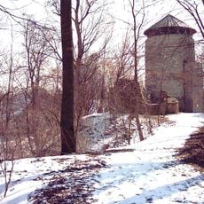
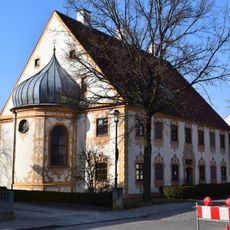
Water level changes in the reservoir can transform the southern section into flowing streams when larger amounts are released, revealing the dynamic nature of water management. On the east side of the lake sits the historic fortress Haltenberg on a hilltop, creating a striking contrast between old history and modern energy production.

The community of curious travelers

AroundUs brings together thousands of curated places, local tips, and hidden gems, enriched daily by 60,000 contributors worldwide.

Start exploring
Location
Elevation above the sea
555.9 m
GPS coordinates
48.14861,10.86639
Latest update
February 9, 2026 11:06
Reviews
Share your experience

No review yet

Discussions
Start a discussion...

No discussion yet

« Lechstaustufe 19 – Schwabstadl » is provided by Around Us (aroundus.com). Images and texts are derived from Wikimedia project under a Creative Commons license. You are allowed to copy, distribute, and modify copies of this page, under the conditions set by the license, as long as this note is clearly visible.

Discover hidden gems everywhere you go!

From secret cafés to breathtaking viewpoints, skip the crowded tourist spots and find places that match your style. Our app makes it easy with voice search, smart filtering, route optimization, and insider tips from travelers worldwide. Download now for the complete mobile experience.

Around Us App Screenshot

A unique approach to discovering new places

Le Figaro

All the places worth exploring

France Info

A tailor-made excursion in just a few clicks

20 Minutes

Around Us
Travel Guide & Maps
Download

Send to your phone

QR Code
1

Open the camera app on your mobile.

2

Point at the QR code with your camera. A notification will appear.

3

Tap the notification to open the link.