LSG-Hoxfeld, protected area in Germany
Location: Borken
Inception: 2001
GPS coordinates: 51.85825,6.76761
Latest update: November 15, 2025 03:53
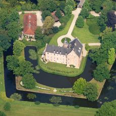
Schloss Rhede
5 km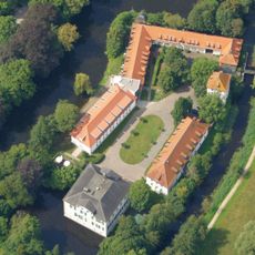
Haus Pröbsting
3.4 km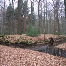
Nunnepollen
1.4 km
Versunken Bokelt
4.2 km
Vardingholt-Süd / Rheder Busch
2.7 km
LSG-Weseker Geest
4.3 km
Josef Bresser Observatory
2.3 km
Rheder Bach
3.6 km
Aa-Niederung, Rheder Busch(L5)
2.7 km
LSG-Klostervenn
4.4 km
Rösing Busch
1.7 km
Feuchtwiesen im Vardingholter Venn
4.2 km
Wayside cross
4.6 km
Priors Pollen
4.5 km
Work of art, installation artwork
3.2 km
Wayside shrine, Christianity
3.8 km
Marienbildnis
2.9 km
Wayside shrine
4.6 km
Wayside cross
2.3 km
Scenic viewpoint
4.7 km
Christus am Ölberg
2 km
Hagelkreuz
3.8 km
Hl. Josef
3.1 km
Hofkreuz
4.4 km
Wayside shrine
3.8 km
Wayside cross
3.8 km
Memorial, war memorial
4.8 km
Wayside cross, Christianity
4.8 kmReviews
Visited this place? Tap the stars to rate it and share your experience / photos with the community! Try now! You can cancel it anytime.
Discover hidden gems everywhere you go!
From secret cafés to breathtaking viewpoints, skip the crowded tourist spots and find places that match your style. Our app makes it easy with voice search, smart filtering, route optimization, and insider tips from travelers worldwide. Download now for the complete mobile experience.

A unique approach to discovering new places❞
— Le Figaro
All the places worth exploring❞
— France Info
A tailor-made excursion in just a few clicks❞
— 20 Minutes