LSG-Wiesen im Schleebach, protected area in Germany
Location: Roetgen
Inception: 2005
GPS coordinates: 50.64992,6.21118
Latest update: November 24, 2023 20:08
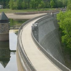
Dreilägerbachtalsperre
1.2 km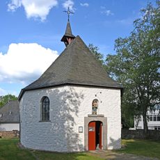
Marienkapelle Roetgen
779 m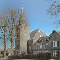
Evangelische Kirche Roetgen
1.8 km
Roetgenbach
518 m
Rote Kouhl
1.9 km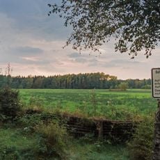
Roetgener Wald
879 m
Roetgener Heckenlandschaft
1.7 km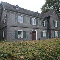
Evangelisches Pfarrhaus
1.8 km
Sophia Owerzarz
1.1 km
Paul Butko
1.2 km
Sternenkinder
1 km
Bronislaw Budas
1.1 km
Milania Kondrat
1.1 km
Wayside shrine
941 m
Wayside shrine
1.1 km
Wayside shrine, Christianity, Catholic church building
1.1 km
Wiedevennkreuz
1.2 km
Zwangsarbeiter
1.2 km
Wayside cross
908 m
Weltkriegsmahnmal
951 m
Scenic viewpoint
1.3 km
Friedenskreuz 1945
1.3 km
Anazobi Gudowskai
1.3 km
Lora Mischenko
1.3 km
Mariengrotte
1.5 km
Wayside shrine
894 m
Wayside cross
758 m
Franziskus I. Wegekreuz
496 mReviews
Visited this place? Tap the stars to rate it and share your experience / photos with the community! Try now! You can cancel it anytime.
Discover hidden gems everywhere you go!
From secret cafés to breathtaking viewpoints, skip the crowded tourist spots and find places that match your style. Our app makes it easy with voice search, smart filtering, route optimization, and insider tips from travelers worldwide. Download now for the complete mobile experience.

A unique approach to discovering new places❞
— Le Figaro
All the places worth exploring❞
— France Info
A tailor-made excursion in just a few clicks❞
— 20 Minutes