Steinbornshohl, Natural monument and sunken lane in Groß-Umstadt, Germany
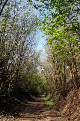
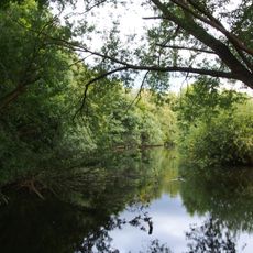
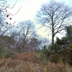
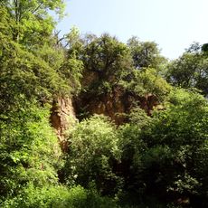
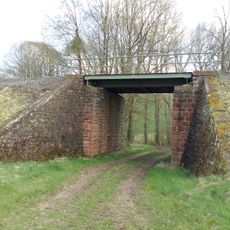
Steinbornshohl is a sunken lane stretching across roughly 800 meters through the landscape, with some sections dropping to depths of 14 meters where the path has worn away over time. The deepest cuts appear where the steepest slopes caused centuries of foot traffic and water flow to carve deeply into the earth.
This route has functioned as a major connection since Roman times, linking together important roads across the Odenwald region. The path's role in ancient trade and travel explains why it became so deeply carved into the landscape.
Local people call this natural formation by its dialect name, showing how deeply it has become part of the area's identity. The name reflects centuries of connection between the community and this landscape feature.
Access to this site is currently restricted due to safety concerns about dead and dying trees that have been assessed by certified experts. Check local conditions before visiting to confirm whether the area is open for walking.
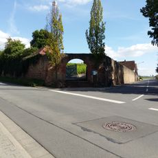
At its lowest point, remains of vaulted cellars from the former Schwanenbrauerei brewery are visible, carved into the slope. Today, lizards and slowworms make their homes in the crevices and openings of these historic structures.
The community of curious travelers
AroundUs brings together thousands of curated places, local tips, and hidden gems, enriched daily by 60,000 contributors worldwide.