
Taunuswälder bei Mudershausen, protected area in the European Union defined by the habitats directive in Rheinland-Pfalz, Germany
Location: Mudershausen
Location: Berghausen
Location: Allendorf
Location: Schiesheim
Location: Katzenelnbogen
Location: Ebertshausen
Location: Klingelbach
Location: Schönborn
Location: Niederneisen
Location: Oberneisen
Location: Lohrheim
Location: Hahnstätten
Inception: 2003
GPS coordinates: 50.29443,8.02674
Latest update: March 3, 2025 02:04
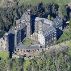
Schaumburg Castle
6.1 km
Burg Katzenelnbogen
4.6 km
Castle Balduinstein
6.7 km
Schwalbach Castle
4 km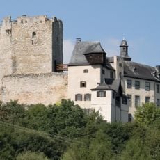
Hohlenfels Castle
542 m
Burg Ardeck
6.8 km
Mensfelder Kopf
7.3 km
Balduinstein station
7.2 km
Ringwall Altschloss
7.8 km
Klosterruine Bärbach
3.2 km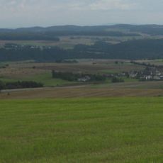
Weißler Höhe
8.2 km
St. Joseph
7.7 km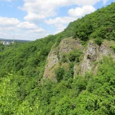
Gabelstein-Hoelloch
7.1 km
Hennethaler Landwehr
7.6 km
Evangelische Kirche Mensfelden
7.8 km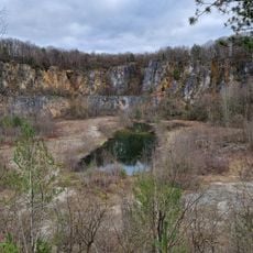
Steinbruch Fachingen
8.4 km
Ergenstein
953 m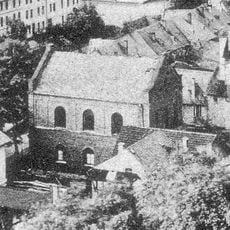
Synagoge (Diez)
8.5 km
Ringwall Weißler Höhe
8.2 km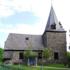
Alte Pfarrkirche in Michelbach
7.4 km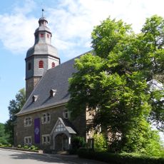
Protestant Church
7.3 km
Evangelische Kirche
6.5 km
Jüdischer Friedhof
3.7 km
Alte Schule
6.6 km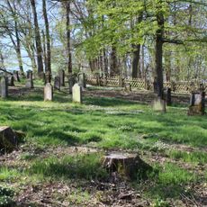
Jewish Cemetery
8.4 km
Hauptstraße 23
6.5 km
Ehem. Volksschule und Schulscheune
7.7 km
Pfarrhaus
7.8 kmReviews
Visited this place? Tap the stars to rate it and share your experience / photos with the community! Try now! You can cancel it anytime.
Discover hidden gems everywhere you go!
From secret cafés to breathtaking viewpoints, skip the crowded tourist spots and find places that match your style. Our app makes it easy with voice search, smart filtering, route optimization, and insider tips from travelers worldwide. Download now for the complete mobile experience.

A unique approach to discovering new places❞
— Le Figaro
All the places worth exploring❞
— France Info
A tailor-made excursion in just a few clicks❞
— 20 Minutes