Toul

Log in to your account

AroundUs is a community-driven map of interesting places, built by curious explorers like you. It grows with every review, story, and photo you share.
Connect to save your favorite spots, contribute locations, and create personalized routes.
Continue with Google
Continue with Apple
Continue with X
Continue with Facebook
Continue with email
By continuing, you accept our Terms and Conditions and our Privacy Policy
Create an account
Add to collection
Map
Suggest a change
Share

Toul, Administrative commune in northeastern Meurthe-et-Moselle, France.

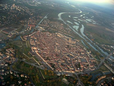
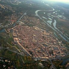
Toul is a town in the Meurthe-et-Moselle region where the Moselle River and the Canal de la Marne au Rhin meet, enclosed by ancient stone fortifications. The town sits at about 215 meters elevation and features medieval structures shaped by its control of water systems.

Originally known as Tullum Leucorum, the city was the center of the Celtic Leuci tribe under Roman control. In 1552, King Henry II incorporated it officially into France, after which it developed as a French frontier town.

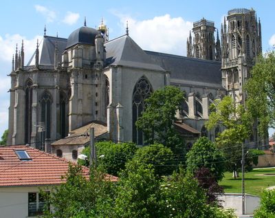
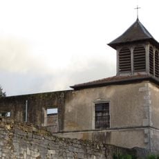
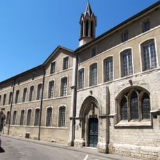
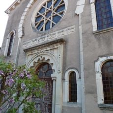
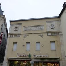
Medieval buildings shape how the town looks today, especially the cathedral with its Gothic details that have guided religious life for centuries. The old town's layout of narrow streets and squares shows how people lived and worked together in this place.

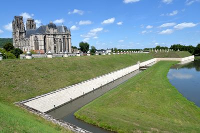
The town connects well to other cities through its main railway station and can also be reached via the Moselle and canal systems. The medieval ramparts shape a walking route through the town and deserve time to explore.

The area produces Gris de Toul, a rosé wine with a distinctive pale pink color rooted in local winemaking tradition. Visitors can explore the vineyards and see how wine production has shaped the region's economic life over time.

Location: Meurthe-et-Moselle

Location: arrondissement of Toul

Elevation above the sea: 226 m

Shares border with: Bicqueley, Bouvron, Bruley, Charmes-la-Côte, Chaudeney-sur-Moselle, Domgermain, Dommartin-lès-Toul, Écrouves, Francheville, Gondreville, Gye, Mont-le-Vignoble, Pagney-derrière-Barine, Villey-Saint-Étienne

Phone: +33383637000

Email: contact@mairie-toul.fr

Website: http://toul.fr

GPS coordinates: 48.67500,5.89167

Latest update: December 14, 2025 18:36

Photos
Reviews

Visited this place? Tap the stars to rate it and share your experience / photos with the community! Try now! You can cancel it anytime.

« Toul - Administrative commune in northeastern Meurthe-et-Moselle, France » is provided by Around Us (aroundus.com). Images and texts are derived from Wikimedia project under a Creative Commons license. You are allowed to copy, distribute, and modify copies of this page, under the conditions set by the license, as long as this note is clearly visible.

Discover hidden gems everywhere you go!

From secret cafés to breathtaking viewpoints, skip the crowded tourist spots and find places that match your style. Our app makes it easy with voice search, smart filtering, route optimization, and insider tips from travelers worldwide. Download now for the complete mobile experience.

Around Us App Screenshot

A unique approach to discovering new places

Le Figaro

All the places worth exploring

France Info

A tailor-made excursion in just a few clicks

20 Minutes